 Filter: Categories of Wisconsin Historical Images
Filter: Subject of Streams
Filter: Subject of human settlements
Filter: Categories of Wisconsin Historical Images
Filter: Subject of Streams
Filter: Subject of human settlements

| Date: | |
|---|---|
| Description: | This map of Vilas County, Wisconsin, from the first half of the 20th century, shows the township and range grid, towns, sections, cities and villages, road... |

| Date: | 1933 |
|---|---|
| Description: | This mid-20th century map shows the township and range grid, towns, sections, cities and villages, roads, railroads, and lakes and streams in Vilas County,... |

| Date: | 1956 |
|---|---|
| Description: | This 1956 map shows sections, cities and villages, roads, railroads, and lakes and streams in the Eagle River area. All or part of the towns of Plum Lake, ... |

| Date: | 1964 |
|---|---|
| Description: | This 1964 maps shows roads, boat landings and marinas, campgrounds, canoe trails and portages, and lakes and streams in parts of Vilas, Oneida, and Iron co... |
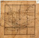
| Date: | 1840 |
|---|---|
| Description: | This 19th century manuscript map shows the roads and proposed routes, villages, and lakes and streams in Walworth County, Wisconsin. |

| Date: | 1896 |
|---|---|
| Description: | This late 19th century map of Walworth County, Wisconsin, shows the township and range grid, towns, sections, villages and post offices, roads, railroads, ... |

| Date: | 1900 |
|---|---|
| Description: | This 1900 map of Walworth County, Wisconsin, shows the township and range grid, towns, sections, landownership and acreages, rural residences, cities and v... |

| Date: | 01 01 1935 |
|---|---|
| Description: | This 1935 map of Walworth County, Wisconsin, shows the township and range grid, towns, sections, cities and villages, highways and roads, railroads, school... |

| Date: | 1896 |
|---|---|
| Description: | This 1896 map of Washburn County, Wisconsin, shows the township and range grid, sections, schools, wagon roads, cities and villages, settlers, railroads, a... |

| Date: | 1909 |
|---|---|
| Description: | This 1909 revision of Harmon's 1896 map of Washburn County, Wisconsin, shows the township and range grid, towns, sections, schools, wagon roads, cities and... |
| Date: | 1900 |
|---|---|
| Description: | This map from the turn of the 20th century shows the township and range grid, sections, towns, land owned by the Starks Levis Land Company of Madison, scho... |

| Date: | 1859 |
|---|---|
| Description: | This 1859 map of Washington County, Wisconsin, shows the township and range grid, towns, sections, landownership and acreages, cities and villages, roads, ... |

| Date: | |
|---|---|
| Description: | This 19th century manuscript map of the Town of Oconomoc, Waukesha County, Wisconsin, is drawn on a printed township grid. It shows landownership and lakes... |

| Date: | 1890 |
|---|---|
| Description: | This late 19th century map shows sections, state lands, Barre Center P.O. (now Barre Mills), railroads, topography, and streams and wetlands in the Town of... |

| Date: | 1882 |
|---|---|
| Description: | This 1882 map of Barron County, Wisconsin, shows the township and range grid, towns, cities and villages, wagon roads, railroads, schools, dwellings, and l... |

| Date: | 1901 |
|---|---|
| Description: | This 1901 map of Barron County, Wisconsin, shows the township and range grid, towns, cities and villages, roads, railroads, and lakes and streams. |

| Date: | 1906 |
|---|---|
| Description: | This 1906 map of Bayfield County, Wisconsin, shows towns, sections, cities, villages and post offices, land ownership, wagon roads, railroads, schools, gov... |

| Date: | 1960 |
|---|---|
| Description: | This mid-20th century tourist brochure for Bayfield County, Wisconsin, includes a map of the county showing towns, cities and villages, highways and roads,... |

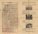
| Date: | 1920 |
|---|---|
| Description: | This manuscript map of southern Bayfield County, Wisconsin, covers the towns of Cable and Drummond and portions of Grandview and Namekagon. Shown are the t... |
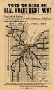
| Date: | 1919 |
|---|---|
| Description: | This flier, likely printed in 1919, promotes the vote for a bond issue to fund "hard roads" in Brown County, Wisconsin. The map shows the 135 miles of conc... |
If you didn't find the material you searched for, our Library Reference Staff can help.
Call our reference desk at 608-264-6535 or email us at: