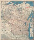
| Date: | 1939 |
|---|---|
| Description: | A color, pictorial map. Scale: 10 miles to the inch. Shows state parks and forests, proposed state parkways, proposed state monuments and memorials, nation... |

| Date: | |
|---|---|
| Description: | View from shoreline of boats docked at the fishing wharf. People are fishing from the pier, and a group of people are in a rowboat near a ferry. There are ... |

| Date: | 1936 |
|---|---|
| Description: | This map shows the state trunk highway system and county trunk highways. This map show surface type on state and county trunk highways and the locations of... |

| Date: | |
|---|---|
| Description: | Drawing of a map showing the cruise routes from Eagle Inn Dock and the points of interest. There is a schedule and rates on the reverse. |
If you didn't find the material you searched for, our Library Reference Staff can help.
Call our reference desk at 608-264-6535 or email us at: