 Filter: Categories of Wisconsin Historical Images
Filter: Subject of Shorelines
Filter: Year of 1700-1799
Filter: Subject of indians of north america
Filter: Categories of Wisconsin Historical Images
Filter: Subject of Shorelines
Filter: Year of 1700-1799
Filter: Subject of indians of north america

| Date: | 1784 |
|---|---|
| Description: | Plate 41. Scene from Cook's Third Expedition, 1776-1779, while in Alaska. |
| Date: | 1784 |
|---|---|
| Description: | Plate 43. Scene from Cook's Third Expedition, 1776-1779, while in Alaska. |

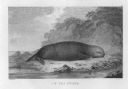
| Date: | 1784 |
|---|---|
| Description: | Plate 45. Scene from Cook's Third Expedition, 1776-1779, while in Alaska. |

| Date: | 1778 |
|---|---|
| Description: | This Italian map from 1778 depicts the upper portion of the Old Northwest. Rivers and lakes are identified and relief, real and imagined, is depicted picto... |

| Date: | 1759 |
|---|---|
| Description: | Map of north eastern Canada and parts of New England, showing settlements, cities, portages, Native American land, mountains, lakes, and rivers. The unusua... |

| Date: | 1795 |
|---|---|
| Description: | Map of South Carolina showing the precincts, cities, towns, Native American villages (marked with a triangle), courthouses, roads, mountains, swamps, islan... |
If you didn't find the material you searched for, our Library Reference Staff can help.
Call our reference desk at 608-264-6535 or email us at: