 Filter: Categories of Wisconsin Historical Images
Filter: Subject of Shorelines
Filter: Type of Map or Atlas
Filter: Categories of Wisconsin Historical Images
Filter: Subject of Shorelines
Filter: Type of Map or Atlas

| Date: | 1930 |
|---|---|
| Description: | These 40 hand-drawn maps depict the survey townships in Oneida County, Wisconsin, on printed township grids. Lakes, rivers, and waterfront properties are d... |

| Date: | 1909 |
|---|---|
| Description: | This 1909 chart of the Apostle Islands, Chequamegon Bay, and the Lake Superior shoreline shows relief by contours and spot heights and depths by contours, ... |

| Date: | 1938 |
|---|---|
| Description: | This tourist map of Door County, Wisconsin, lists the points of interest and resorts in the area. An inset location map is included. |

| Date: | 1948 |
|---|---|
| Description: | This 1948 map shows contour and spot depths in Lake Wingra in Madison, Wisconsin. The shore outline is based on a 1940 aerial photograph. |

| Date: | 1930 |
|---|---|
| Description: | "Issued by Door County Chamber of Commerce." Shows federal system highways, state highways, county trunk highways, country roads, and parks. Includes direc... |
| Date: | 1935 |
|---|---|
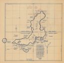
| Description: | This map shows property owners, government lots, and roads around Pine Lake in Rusk and Chippewa Counties. Also shows Silver and McDonald Lakes. "This map ... |

| Date: | 1836 |
|---|---|
| Description: | This map is pen-and-ink on paper and shows marshlands, rivers, creeks, a quarry, and a few roads. |

| Date: | 1964 |
|---|---|
| Description: | A simple map of the Mississippi Project. There are symbols at the bottom marking locations for: Voter Registration, Freedom School, Community Center and Pr... |

| Date: | 1900 |
|---|---|
| Description: | This map of West Navarino shows plat of the town, lots by number, local streets, public square, The Fox River, and Fort Howard. The bottom of the map reads... |

| Date: | 1881 |
|---|---|
| Description: | Bird's-eye view of Milwaukee from the south lakeshore. |

| Date: | 1945 |
|---|---|
| Description: | This map shows wards and precincts and includes a list of polling places by ward and precinct. The map reads: "Keep this Map . . . It Gives the Location of... |

| Date: | 1948 |
|---|---|
| Description: | This map shows wards and precincts and includes a list of polling places by ward and precinct. The map reads: "Keep this Map . . . It Gives the Location of... |

| Date: | 1953 |
|---|---|
| Description: | This map is a blue line print and shows streets as well as some points of interest. |

| Date: | |
|---|---|
| Description: | A decorative map of Fuller's Woods development along the Lake Mendota shoreline. Includes numbered lots and building line setbacks with decorative features... |

| Date: | 1908 |
|---|---|
| Description: | A detail of a Madison Sanborn map that includes the University of Wisconsin Boat House, UW Gymnasium & Armory (The Red Gym), fraternity houses, and the YMC... |

| Date: | 1858 |
|---|---|
| Description: | This map of Wisconsin and Minnesota shows proposed railroads, copper mines, marshes, villages, mills, reefs, notes about shorelines, and references to mini... |

| Date: | 1948 |
|---|---|
| Description: | This map shows a list of polling places by ward and precinct in the left margin, a list of assembly districts, and additional handwritten notes. Lake Michi... |

| Date: | 1910 |
|---|---|
| Description: | This map is a survey of Kenosha Harbor and shows local streets, public buildings, local businesses, and part of Lake Michigan. Included is text on sailing ... |

| Date: | 1923 |
|---|---|
| Description: | Map showing the parcel of land on the shore of Lake Monona acquired by the City of Madison for a park (today known as Olbrich Park). |

| Date: | 1902 |
|---|---|
| Description: | This map is a chart of Milwaukee Harbor that displays local streets, bridges, roads, railroads, public buildings, businesses, factories, dry docks, parks, ... |
If you didn't find the material you searched for, our Library Reference Staff can help.
Call our reference desk at 608-264-6535 or email us at: