 Filter: Categories of Wisconsin Historical Images
Filter: Subject of Ships
Filter: Subject of inland water transportation
Filter: Categories of Wisconsin Historical Images
Filter: Subject of Ships
Filter: Subject of inland water transportation

| Date: | 07 1959 |
|---|---|
| Description: | Dickey Chapelle, photographer, on the same Milwaukee beach where she learned to swim as a young girl. She was covering "Operation Inland Seas" celebrating ... |
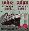
| Date: | 1926 |
|---|---|
| Description: | The cover from the 1926 schedule lists the ports of call for the Goodrich fleet and features a drawing of the "Alabama". |

| Date: | 1873 |
|---|---|
| Description: | Bird's-eye map of La Crosse from the Mississippi River. |
| Date: | |
|---|---|
| Description: | View of the steamer ship "Islander" leaving Mackinac Island. Signs painted on the ship reads=: "Islander," "Arnold Line" and "St. Ignace Mackinac Island" (... |
| Date: | |
|---|---|
| Description: | Elevated view of the "City of Charlevoix" ship coming into harbor. The sign painted on the front of the ship reads: "Northern Michigan Line" and "City of C... |

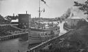
| Date: | 1905 |
|---|---|
| Description: | A view of the U.S. snagboat "E.A. Woodruff" at a wharf. "U.S. Snag Boat E.A. Woodruff" signs are on the side of the boat. A bridge and two paddle ships are... |

| Date: | 06 14 1961 |
|---|---|
| Description: | Aerial view of North and South Harbor Tracts, looking north from South Pier No. 2. There are skyscrapers in the background. there are multiple items of mac... |

| Date: | 1776 |
|---|---|
| Description: | Map of the Delaware Bay, River, their shoreline, made to aid ships in navigating to Philadelphia. It is oriented with north to the right and shows inlets, ... |

| Date: | 1936 |
|---|---|
| Description: | This colored road map shows automobile roads in Wisconsin as well as portions of nearby states. U.S. numbered highways are shown in red, and information ab... |
If you didn't find the material you searched for, our Library Reference Staff can help.
Call our reference desk at 608-264-6535 or email us at: