 Filter: Categories of Wisconsin Historical Images
Filter: Subject of Science
Filter: Type of Manuscript
Filter: Subject of intellectual life
Filter: Categories of Wisconsin Historical Images
Filter: Subject of Science
Filter: Type of Manuscript
Filter: Subject of intellectual life
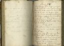
| Date: | 10 1827 |
|---|---|
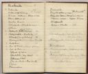
| Description: | Open spread of Increase Lapham's diary from October 6, 1827 to April 18, 1828. |
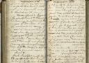
| Date: | 1828 |
|---|---|
| Description: | Open spread of Increase Lapham's diary. |
| Date: | 1835 |
|---|---|
| Description: | Page from Increase Lapham's 1935 botanical diary in which he listed plants he observed in flower stage. |
| Date: | 1838 |
|---|---|
| Description: | Page from Increase Lapham's 1838 botanical diary in which he listed plants he observed in flower stage. |
| Date: | 1870 |
|---|---|
| Description: | Page from a diary kept by Increase Lapham in California between April 11 and May 19, 1870. The page shows a portion of a list of minerals of California. |
| Date: | 07 22 1827 |
|---|---|
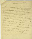
| Description: | Letter from Benjamin Sillman to Increase Lapham requesting information about the canal around the rapids of the Ohio River for inclusion in The Journal ... |

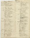
| Date: | 1849 |
|---|---|
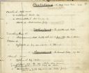
| Description: | Handwritten list of plants in the Ranunculaceae or crowfoot family. |
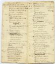
| Date: | 1845 |
|---|---|
| Description: | Page from Increase Lapham's 1845 list of plants of Wisconsin including Oxalidaceae, Zanthoxylaceae, and Anacardiaceae and notations of where and when indiv... |

| Date: | 1844 |
|---|---|
| Description: | Increase Lapham's handwritten title page for A Geographical and Topographical Description of Wisconsin |
| Date: | 1838 |
|---|---|
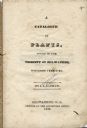
| Description: | Title page of Increase Lapham's Catalog of Plants Found in the vicinity of Milwaukee, Wisconsin Territory. |

| Date: | 01 13 1937 |
|---|---|
| Description: | Sketch map of Township 7 North, Range 9 East, created for the Land Economic Inventory (Bordner Survey). The map shows Picnic Point and the Lake Mendota sho... |
If you didn't find the material you searched for, our Library Reference Staff can help.
Call our reference desk at 608-264-6535 or email us at: