
| Date: | 1891 |
|---|---|
| Description: | Bird's-eye map of Wausau, looking north with ninety-eight businesses, industries, churches, schools, and civic buildings identified in location key below i... |

| Date: | 1867 |
|---|---|
| Description: | Bird's-eye map of Berlin, with insets of West Side Public School and High School. |

| Date: | 1900 |
|---|---|
| Description: | A map of Marinette County, Wisconsin shows the township and range system, sections, towns, cities and villages, streams and lakes, railroads, roads, school... |

| Date: | 1896 |
|---|---|
| Description: | A map of Milwaukee County, Wisconsin that shows the township and range system, sections, towns, roads, railroads and rail stations, cities and villages, po... |
| Date: | 1877 |
|---|---|
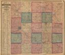
| Description: | A map of Monroe County, Wisconsin that shows the townships and landownership and acreage wagon roads, railroads, streams, schools, and houses. Also include... |

| Date: | 1922 |
|---|---|
| Description: | This map from the early to mid-20th century shows the township and range system, towns, cities and villages, roads, railroads, schools, churches, and lakes... |
| Date: | 1903 |
|---|---|
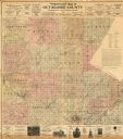
| Description: | This 1903 map of Outagamie County, Wisconsin, shows the township and range grid, towns, sections, cities and villages, landownership and acreages, rural ma... |
| Date: | |
|---|---|
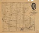
| Description: | This 1907 map of Outagamie County, Wisconsin, shows the township and range grid, towns, sections, cities and villages, railroads, wagon roads, churches, sc... |
| Date: | 1922 |
|---|---|
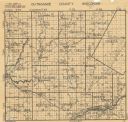
| Description: | This map of Outagamie County, Wisconsin, from the first half of the 20th century, shows the township and range grid, towns, sections, cities and villages, ... |

| Date: | 1922 |
|---|---|
| Description: | This map of Pierce County, Wisconsin, from the first half of the 20th century, shows the township and range grid, towns, sections, villages, roads, railroa... |

| Date: | |
|---|---|
| Description: | This map from the early 20th century shows the township and range grid, towns, sections, cities and villages, railroads, roads, schools, churches, and stre... |

| Date: | |
|---|---|
| Description: | This map from the early 20th century shows the township and range grid, towns, sections, cities and villages, railroads, roads, schools, churches, cemeteri... |
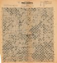
| Date: | 1896 |
|---|---|
| Description: | This 1896 map shows the township and range system, sections, cities and villages, railroads, vacant land and land sold by the Wisconsin Central Railroad, s... |

| Date: | 1914 |
|---|---|
| Description: | This map of Price County, Wisconsin, from the early 20th century shows land for sale by the Homemaker Land Company of Milwaukee. The township and range sys... |

| Date: | 1888 |
|---|---|
| Description: | This late 19th century map of Price County, Wisconsin, shows landownership and waterfront acreages, the township and range system, towns, cities and villag... |
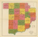
| Date: | 1939 |
|---|---|
| Description: | This map of Sauk County, Wisconsin, shows the township and range grid, towns, sections, cities and villages, roads, railroads, lakes and rivers, schools, a... |

| Date: | 1897 |
|---|---|
| Description: | This 1897 map of Sawyer County, Wisconsin, shows the township and range system, sections, roads, farm houses, camps, school houses, dams, bridges, Indian r... |
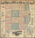
| Date: | 1862 |
|---|---|
| Description: | This 1862 map of Sheboygan County, Wisconsin, shows land ownership and acreages, the township and range grid, towns, cities and villages, roads, railroads,... |
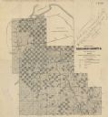
| Date: | 1900 |
|---|---|
| Description: | This 1900 map shows the township and range system, sections, cities and villages, railroads, roads, vacant land and land sold by the Wisconsin Central Rail... |
If you didn't find the material you searched for, our Library Reference Staff can help.
Call our reference desk at 608-264-6535 or email us at: