 Filter: Categories of Wisconsin Historical Images
Filter: Subject of School buildings
Filter: Type of Map or Atlas
Filter: Categories of Wisconsin Historical Images
Filter: Subject of School buildings
Filter: Type of Map or Atlas

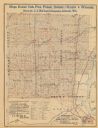
| Date: | 1903 |
|---|---|
| Description: | Map shows railroads, roads, street car lines, schools, churches, cemeteries, town halls, and railroad stations. Includes inset lists of: Population of Milw... |

| Date: | 1831 |
|---|---|
| Description: | Map of the city of Louisville, Kentucky on the Ohio River showing streets and numbered lots. The Ohio River, Corn Island, and the Louisville and Portland C... |
| Date: | 1890 |
|---|---|
| Description: | The map shows roads and railroads, houses, schools, town halls, and other points of interest in parts of Shawano, Oconto, and Brown counties. The lower lef... |

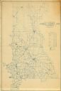
| Date: | 1873 |
|---|---|
| Description: | Map shows townships and sections, landownership and acreages, state and county lands, churches, schools, cemeteries, roads, and railroads. There is an inse... |

| Date: | 1901 |
|---|---|
| Description: | Map shows townships, schools, creameries, post offices, and roads. The left side of the map features a legend with symbols for points of interest. |

| Date: | 1914 |
|---|---|
| Description: | Map shows townships, schools, creameries, post offices, and roads. The left side of the map features a legend with symbols for points of interest. |

| Date: | 1952 |
|---|---|
| Description: | Map shows roads, highways, railroads, parks, city buildings, schools, cemeteries, city limits, and the Fox River. The map is indexed by street name, street... |

| Date: | 1911 |
|---|---|
| Description: | Map shows in blue roads, railroads, post offices, schools, houses, churches, and routes. The map includes a chart of "Explanation" that acts as a legend. T... |

| Date: | 1872 |
|---|---|
| Description: | Map shows townships and sections, landownership, roads, railroads, churches, schools, and cemeteries. The map includes business directories of Watertown, J... |
| Date: | 1912 |
|---|---|
| Description: | Map shows roads, railroads, post offices, schools, houses, churches, routes, and post office collection boxes. The map includes a distant chart and explana... |

| Date: | 1857 |
|---|---|
| Description: | Map of La Crosse County, Wisconsin showing village plat, farm houses, schools, roads, railroads, township names (New Amsterdam, Dacota, Minnesota, Driesbac... |

| Date: | 1910 |
|---|---|
| Description: | Map is a blueline print. Map shows United States postal routes for La Crosse County. A list of stations include: Bangor R R 1-3, Holmen R R 1-2, La Crosse ... |

| Date: | 1931 |
|---|---|
| Description: | Relief shown by contours and spot heights. Maps shows United States, state, county and local highways and roads, schools, North Bend, creeks, lakes, rivers... |

| Date: | 1874 |
|---|---|
| Description: | Bird's-eye view map of Appleton, Wisconsin. Map reads: "NOTE.-Since the above cut was engraved, the Fox River Pulp & Paper Co.'s Mammoth Mills have been er... |

| Date: | 1931 |
|---|---|
| Description: | Map shows street map with wards numbered, the Fox River, railroads, playgrounds, cemeteries, and schools. The map also includes a manuscript annotation ind... |

| Date: | 01 1940 |
|---|---|
| Description: | Map shows roads, railroads, the Fox River, parks, schools, and cemeteries and is indexed by street name in the margins. The bottom of the map show the Winn... |

| Date: | 1957 |
|---|---|
| Description: | Map is indexed by street name in the margins. The map shows roads, highways, railroads, parks, city buildings, schools, cemeteries, city limits, and the Fo... |

| Date: | 1903 |
|---|---|
| Description: | Map shows location of government buildings, schools, churches, parks, and other points of interest. The upper left hand margin features a "Reference" secti... |

| Date: | 1878 |
|---|---|
| Description: | This bird’s-eye-view map of Barton is indexed for parochial and public schools, churches, a convent, the railroad depot, and the post office. |

| Date: | 1916 |
|---|---|
| Description: | This map of Racine includes an indexed street directory, schools, public buildings, parks, directory of buildings, and churches. The map includes 3 illustr... |
If you didn't find the material you searched for, our Library Reference Staff can help.
Call our reference desk at 608-264-6535 or email us at: