 Filter: Categories of Wisconsin Historical Images
Filter: Subject of School buildings
Filter: Type of Map or Atlas
Filter: Categories of Wisconsin Historical Images
Filter: Subject of School buildings
Filter: Type of Map or Atlas

| Date: | 1909 |
|---|---|
| Description: | This map covers Iron and Price Counties and portions of Sawyer and Oneida Counties. The map shows vacant and sold Wis. Central Ry. land, settlers houses, s... |

| Date: | 1877 |
|---|---|
| Description: | This map is a photstat copy of the original and shows landownership, townships and sections, wagon roads, railroads, school houses, churches, cemeteries, m... |

| Date: | 1980 |
|---|---|
| Description: | This map shows schools, hotels, stations, roads, railroads, reefs, and public buildings. The upper right corner includes "A Summer and Winter Guide for Spo... |
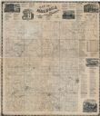
| Date: | 1874 |
|---|---|
| Description: | This map shows townships and sections, land ownership and acreages, churches, schools, cemeteries, roads, railroads, and projected railroads. The map inclu... |

| Date: | 1910 |
|---|---|
| Description: | A Sanborn insurance map of Milwaukee, including the shore of Lake Michigan. |

| Date: | 06 12 1929 |
|---|---|
| Description: | This manuscript blueprint shows buildings with the names of their owners, tabernacle, location "where Strang found plates" and "house where Strang died," a... |

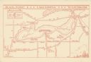
| Date: | 1961 |
|---|---|
| Description: | This map shows the lake, clubs, resorts, motels, school house, public approaches, and public parks. The back of map includes advertisements and text. |

| Date: | 1894 |
|---|---|
| Description: | This map shows railroads, street railways, ward lines, land parcels, streets, schools and public buildings. Ward lines are highlighted in red. Lake Michiga... |
| Date: | 1935 |
|---|---|
| Description: | This map shows Black Point estate including buildings and signs, as well as a school and store near the village of Linton, country clubs, roads, Yerkes Obs... |

| Date: | 1874 |
|---|---|
| Description: | Birds-eye view of Appleton Wisconsin. In the foreground are people fishing, strolling, and looking over the canal towards the Fox River. Streets and buildi... |
If you didn't find the material you searched for, our Library Reference Staff can help.
Call our reference desk at 608-264-6535 or email us at:
