 Filter: Categories of Wisconsin Historical Images
Filter: Subject of Sawmills
Filter: Subject of lakes
Filter: Subject of architecture
Filter: Categories of Wisconsin Historical Images
Filter: Subject of Sawmills
Filter: Subject of lakes
Filter: Subject of architecture
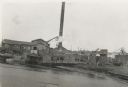
| Date: | 1939 |
|---|---|
| Description: | A view from water of the Thunder Lake Lumber Co., one of the largest sawmills in Rhinelander. It was located on Lake Creek and operated until 1937. |

| Date: | 1909 |
|---|---|
| Description: | A map of Langlade County, Wisconsin that shows townships and ranges, towns, cities and villages, wagon roads, churches, schools, sawmills, town halls, chee... |

| Date: | 1915 |
|---|---|
| Description: | This 1915 map of Lincoln County, Wisconsin, shows the township and range grid, towns, cities and villages, lakes and streams, residences, churches, school ... |

| Date: | 1896 |
|---|---|
| Description: | This 1896 map shows the township and range system, sections, cities and villages, railroads, vacant land and land sold by the Wisconsin Central Railroad, s... |

| Date: | 1914 |
|---|---|
| Description: | This 1914 map of Price County, Wisconsin, shows land for sale by the Good Land Company and Dewitt van Ostrand of Phillips. Also shown are the township and ... |

| Date: | 1896 |
|---|---|
| Description: | This 1896 map shows the township and range system, sections, cities and villages, railroads, roads, vacant land and land sold by the Wisconsin Central Rail... |

| Date: | 1900 |
|---|---|
| Description: | This 1900 map shows the township and range system, sections, cities and villages, railroads, roads, vacant land and land sold by the Wisconsin Central Rail... |

| Date: | 1887 |
|---|---|
| Description: | This 1896 map shows the township and range system, sections, cities and villages, railroads, roads, vacant land and land sold by the Wisconsin Central Rail... |

| Date: | 1898 |
|---|---|
| Description: | This 1898 map shows the township and range system, sections, cities and villages, railroads, roads, vacant land and land sold by the Wisconsin Central Rail... |

| Date: | 1909 |
|---|---|
| Description: | This map covers Iron and Price Counties and portions of Sawyer and Oneida Counties. The map shows vacant and sold Wis. Central Ry. land, settlers houses, s... |
If you didn't find the material you searched for, our Library Reference Staff can help.
Call our reference desk at 608-264-6535 or email us at:
