| Date: | 1870 |
|---|---|
| Description: | Bird's-eye view of the city of Manitowoc with a population of 5,168 inhabitants as it appears in 1870, the year the village was granted a city charter by t... |

| Date: | 1966 |
|---|---|
| Description: | A colored map depiction of Door County, Wisconsin, with pictorial highlights, titled: "Door County — Wisconsin's Air Conditioned Peninsula Playground." |

| Date: | 1950 |
|---|---|
| Description: | Inside spread illustration of the world, with a legend indicating: Subsidiary Company, Branch of Subsidiary, Representative, Works, and Distributor. |

| Date: | 1790 |
|---|---|
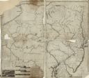
| Description: | This map of the north eastern states shows roads, rivers, lakes, waterfalls, mountains, cities, forts, mills, the Oneida Reservation, and "New York Donatio... |

| Date: | 1776 |
|---|---|
| Description: | Map of New Jersey and New York, showing cities, forts, roads, counties, townships, land grants, rivers, lakes and several topographical features. Much of t... |

| Date: | |
|---|---|
| Description: | Illustrated map of Lake Geneva surrounded by views of points of interest including; Yerkes Observatory, an excursion boat, a pier, a lakeside drive, sailin... |
If you didn't find the material you searched for, our Library Reference Staff can help.
Call our reference desk at 608-264-6535 or email us at: