 Filter: Categories of Wisconsin Historical Images
Filter: Subject of Roads
Filter: Subject of persons
Filter: Type of Map or Atlas
Filter: Categories of Wisconsin Historical Images
Filter: Subject of Roads
Filter: Subject of persons
Filter: Type of Map or Atlas

| Date: | 1857 |
|---|---|
| Description: | Elevated view of Waukesha with two women wearing dresses with a boy in long pants and tam o'shanter hat in foreground against a split-rail fence. Beyond th... |

| Date: | 1870 |
|---|---|
| Description: | Bird's-eye view of Whitewater, with insets. |

| Date: | 1860 |
|---|---|
| Description: | Bird's-eye drawing of New Glarus. |

| Date: | 1949 |
|---|---|
| Description: | Color bird's-eye map of the University of Wisconsin-Madison as it was midcentury, with two co-eds, several photographs of campus landmarks around edges, an... |
| Date: | 04 22 1915 |
|---|---|
| Description: | Topographical survey of a McCormick family property in Lake Forest, Illinois. The survey was completed for Anita McCormick [Mrs. Emmons] Blaine. The survey... |

| Date: | 1958 |
|---|---|
| Description: | Includes images of Flambeau River State Forest and a description of, canoeing and recreational activities in, and general park and forest information about... |

| Date: | 1936 |
|---|---|
| Description: | This pictorial tourist map from the Wisconsin Conservation Commission depicts vacation activities and identifies tourist destinations throughout the state.... |

| Date: | 1946 |
|---|---|
| Description: | A map showing the roads, railroads, towns, cities and villages, streams and lakes, airports, schools, churches, cemeteries, and golf courses in Kenosha Cou... |

| Date: | 1990 |
|---|---|
| Description: | A tourist map of Lafayette County, Wisconsin, that shows the locations of motels, camping, municipal parks, cheese factory tours, waysides, and golf course... |

| Date: | |
|---|---|
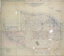
| Description: | This 1907 map of Outagamie County, Wisconsin, shows the township and range grid, towns, sections, cities and villages, railroads, wagon roads, churches, sc... |

| Date: | 1949 |
|---|---|
| Description: | This 1949 tourism brochure for the Hayward region includes a directory of members of the Hayward Lakes Resort Association, color illustrations, descriptive... |

| Date: | 1990 |
|---|---|
| Description: | This tourism brochure of Ashland County, Wisconsin, from the Ashland Area Chamber of Commerce includes a map of the county showing tourist destinations and... |

| Date: | 1960 |
|---|---|
| Description: | This mid-20th century tourist brochure for Bayfield County, Wisconsin, includes a map of the county showing towns, cities and villages, highways and roads,... |

| Date: | 1967 |
|---|---|
| Description: | This tourist brochure for Bayfield County, Wisconsin, from 1967 includes a map of the county showing towns, cities and villages, highways and roads, railro... |

| Date: | 1955 |
|---|---|
| Description: | This 1950s tourist brochure features a map of Burnett County, Wisconsin, and northern Polk County which shows highways and roads, railroads, landmarks, and... |

| Date: | 1991 |
|---|---|
| Description: | This 1991 map of Burnett County, Wisconsin, shows Governor Knowles State Forest, wildlife areas, public hunting grounds, and other outdoor recreation facil... |

| Date: | 1860 |
|---|---|
| Description: | This map of Dodge County, Wisconsin, shows the township and range grid, towns, sections, cities and villages, railroads, roads, property owners and acreage... |

| Date: | 1835 |
|---|---|
| Description: | Shows Walker’s Point, Juneau Town and Kilbourn Town, including labeled buildings, trails and Indian villages. Relief shown by hachures. Oriented with north... |

| Date: | 1902 |
|---|---|
| Description: | Map reads: "Milwaukee's Polish Population. Map showing in Red Color the Location and Density of Polish=Speaking Population of the City of Milwaukee, Wis." ... |
If you didn't find the material you searched for, our Library Reference Staff can help.
Call our reference desk at 608-264-6535 or email us at:
