Filter: Categories of Wisconsin Historical Images
Filter: Subject of Roads
Filter: County of Grant
Filter: Categories of Wisconsin Historical Images
Filter: Subject of Roads
Filter: County of Grant
| Date: | 1921 |
|---|---|
| Description: | Exterior view of Ludden's Poultry and Eggs from the dirt road. The shop features a porch, gable roof, and fenced yard. There are wooden crates and barrels ... |
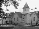
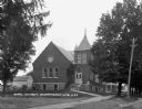
| Date: | 1925 |
|---|---|
| Description: | View of the church from across the intersection. The church building features a french door with a fanlight, arched windows, and a steeple. |
| Date: | |
|---|---|
| Description: | A woman stands on a wooden footbridge. There are homes in the distance. |
| Date: | |
|---|---|
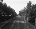
| Description: | A dirt road with trees on one side and a fence on the other. A carriage is approaching. |
| Date: | 1913 |
|---|---|
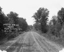
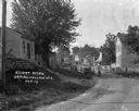
| Description: | View down middle of tree-lined road of a carriage approaching from a distance. |
| Date: | 1913 |
|---|---|
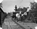
| Description: | A man drives a team of horses pulling a wagon across a bridge. The man is standing atop the barreled goods, holding the reins. There is dung on the road. |
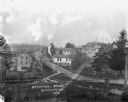
| Date: | 1913 |
|---|---|
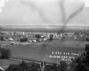
| Description: | Bird's-eye view of the village. Cropland and barns cover much of the landscape. |
| Date: | |
|---|---|
| Description: | A bird's-eye view of a farmland property with barns and farmhouse. |
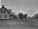
| Date: | |
|---|---|
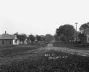
| Description: | View down an unpaved residential road. Houses are in the background. |

| Date: | |
|---|---|
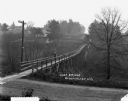
| Description: | View of a bridge over a stream. In the foreground is a tree. Residential homes are in the distance. |
| Date: | |
|---|---|
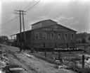
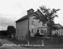
| Description: | Exterior of a feed mill erected About 1840. There is an advertisement for Quaker Ful-O-Pep feed above the entrance. Two pickup trucks are parked outside. |
| Date: | 1918 |
|---|---|
| Description: | View down road of children posing on the side of the road. Two people sit in an automobile. In the background are commercial buildings, and horse-drawn veh... |
| Date: | 1918 |
|---|---|
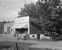
| Description: | The exterior of P.J. Blindert's general store, with an awning over the storefront, and a loading dock on the left. A man and a woman stand in the road in f... |
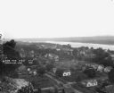
| Date: | 1921 |
|---|---|
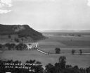
| Description: | View from bluff of Cassville with the Mississippi River in the background. |

| Date: | 1921 |
|---|---|
| Description: | The site of the Klindt-Geiger Canning Company, operated from 1893 to 1950. The factory features a water tower. |
If you didn't find the material you searched for, our Library Reference Staff can help.
Call our reference desk at 608-264-6535 or email us at: