| Date: | 1907 |
|---|---|
| Description: | Shows roads, railroads, lakes, rivers, churches, and camps. |

| Date: | 1880 |
|---|---|
| Description: | View along Central Avenue. There are a number of commercial buildings with false fronts. Groups of people stand near the road on the left and right. |

| Date: | 1960 |
|---|---|
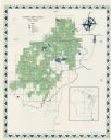
| Description: | This map shows uplands and swamps owned by the Goodman Lumber Division, water, and roads. The lower right corner includes a location map. The upper left co... |
If you didn't find the material you searched for, our Library Reference Staff can help.
Call our reference desk at 608-264-6535 or email us at: