Filter: Categories of Wisconsin Historical Images
Filter: Subject of Roads
Filter: Type of Map or Atlas
Filter: Categories of Wisconsin Historical Images
Filter: Subject of Roads
Filter: Type of Map or Atlas

| Date: | 1857 |
|---|---|
| Description: | Elevated view of Waukesha with two women wearing dresses with a boy in long pants and tam o'shanter hat in foreground against a split-rail fence. Beyond th... |

| Date: | 1880 |
|---|---|
| Description: | Bird's-eye map of Waukesha, county seat of Waukesha County. |

| Date: | 1885 |
|---|---|
| Description: | Bird's-eye map of Waupun on the Rock River. There is an inset at top center of "Althouse, Wheeler & Co., Windmills and Pumps." |

| Date: | 1892 |
|---|---|
| Description: | Color bird's-eye map of Wauwatosa, looking east toward Milwaukee and Lake Michigan. Predominantly green with cream colored roadways, with six land plots ow... |

| Date: | 1875 |
|---|---|
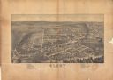
| Description: | Bird's-eye map of Black River Falls, looking southwest. |

| Date: | 1871 |
|---|---|
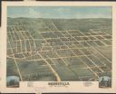
| Description: | Birds eye map of Brodhead, WI depicts street names and street locations, houses, and trees. A reference key at the bottom of the map shows the locations of... |

| Date: | 1882 |
|---|---|
| Description: | This map of Cedarburg is a bird's-eye map with an inset of Cedarburg Brewery. Relief is shown pictorially and the map includes an index to buildings. |

| Date: | 1896 |
|---|---|
| Description: | Bird's-eye map of Darlington. Area bordered by Washington and North Streets, upper left hand corner, the fairgrounds, upper right corner, River Street, bot... |
| Date: | 1875 |
|---|---|
| Description: | Bird's-eye map of Dodgeville, looking east, with insets of the high school and county courthouse. |

| Date: | 1872 |
|---|---|
| Description: | Birds-eye drawing of Eau Claire depicts street names and street locations, houses, trees, bridges, piers, canals, railroads, and the Chippewa and Eau Clair... |

| Date: | 1879 |
|---|---|
| Description: | Bird's-eye map of Hartford. |

| Date: | 1892 |
|---|---|
| Description: | This bird's-eye view map is oriented looking north-east and includes index of points of interest and businesses. The map is a photocopy. |

| Date: | 1885 |
|---|---|
| Description: | Bird's-eye map of Hustisford. |

| Date: | 1878 |
|---|---|
| Description: | Bird's-eye map of Kewaskum. Includes a list of hotels, churches, post office, railroad depot, etc. |

| Date: | 1870 |
|---|---|
| Description: | Bird's-eye map of Kilbourn City, now known as Wisconsin Dells. Kilbourn City was platted in the 1850s and received a boost when the La Crosse and Milwaukee... |

| Date: | 1879 |
|---|---|
| Description: | Bird's-eye map of Lake Mills. |

| Date: | 1874 |
|---|---|
| Description: | Bird's-eye map of Lodi, with inset of Public School. Includes index of churches and points of interest. |
If you didn't find the material you searched for, our Library Reference Staff can help.
Call our reference desk at 608-264-6535 or email us at: