Filter: Categories of Wisconsin Historical Images
Filter: Subject of Roads
Filter: Type of Map or Atlas
Filter: Categories of Wisconsin Historical Images
Filter: Subject of Roads
Filter: Type of Map or Atlas
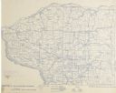
| Date: | 1896 |
|---|---|
| Description: | This map shows 12 sections of bicycle road maps. Sections and number are in red, counties are in blue. |

| Date: | 1896 |
|---|---|
| Description: | Section 3 of 12, this bicycle road map features Wisconsin bicycle routes in the counties of Winnebago, Calumet, Manitowoc, Outagamie, Brown, Kewaunee, and ... |
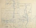
| Date: | 1896 |
|---|---|
| Description: | Section 4 of 12, this bicycle road map features Wisconsin bicycle routes in the counties of Iowa, Grant, and La Fayette. |

| Date: | 1896 |
|---|---|
| Description: | Section 5 of 12, this bicycle road map features Wisconsin bicycle routes in the counties of La Crosse, Monroe, Vernon, Crawford, Richland, Sauk, Juneau, an... |

| Date: | 1896 |
|---|---|
| Description: | Section 6 of 12, this bicycle road map features Wisconsin bicycle routes in the counties of Wood, Portage, Waupaca, Washara, Juneau, and Adams. |

| Date: | 1896 |
|---|---|
| Description: | Section 7 of 12, this bicycle road map features Wisconsin bicycle routes in the counties of Pierce, Pepin, Dunn, Eau Claire, Trempealeau, Jackson, and Clar... |
| Date: | 1896 |
|---|---|
| Description: | Section 8 of 12, this bicycle road map features Wisconsin bicycle routes in the counties of Langlade, Shawano, Oconto, and Marinette. |
| Date: | 1896 |
|---|---|
| Description: | Section 9 of 12, this bicycle road map features Wisconsin bicycle routes in the counties of Taylor, Marathon, Lincoln, and Price. |

| Date: | 1896 |
|---|---|
| Description: | Section 10 of 12, this bicycle road map features Wisconsin bicycle routes in the counties of Polk, Barron, Chippewa, St. Croix, and Dunn. |
| Date: | 1896 |
|---|---|
| Description: | Section 11 of 12, this bicycle road map features Wisconsin bicycle routes in the counties of Vilas, Oneida, Forest, Florence, and Marinette. |

| Date: | 1896 |
|---|---|
| Description: | Section 12 of 12, this bicycle road map features Wisconsin bicycle routes in the counties of Douglas, Bayfield, Burnett, Washburn, Sawyer, Price, Ashland, ... |

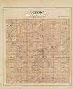
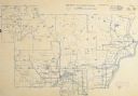
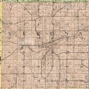
| Date: | 1890 |
|---|---|
| Description: | A plat map of a portion of Verona in Dane County. |
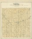
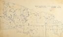
| Date: | 1914 |
|---|---|
| Description: | The Verona township, a detail of the Dane County, Wisconsin map of land ownership. |
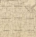
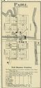
| Date: | 1904 |
|---|---|
| Description: | A map of Verona, which is a detail from a map of Dane County, Wisconsin. |

| Date: | 1911 |
|---|---|
| Description: | A map of the village of Black Earth and Verona. |
If you didn't find the material you searched for, our Library Reference Staff can help.
Call our reference desk at 608-264-6535 or email us at: