Filter: Categories of Wisconsin Historical Images
Filter: Subject of Rivers
Filter: Year of 1800-1899
Filter: Categories of Wisconsin Historical Images
Filter: Subject of Rivers
Filter: Year of 1800-1899

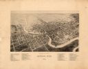
| Date: | 1885 |
|---|---|
| Description: | Bird's-eye map of Oconomowoc. |

| Date: | 1850 |
|---|---|
| Description: | Bird's-eye view of business district of Oshkosh, "drawn after nature" by the artist. |

| Date: | 1867 |
|---|---|
| Description: | Bird's-eye view of Oshkosh, "drawn from nature." |

| Date: | 1885 |
|---|---|
| Description: | Bird's-eye view of Sheboygan, with inset of J.J. Volrath Manufacturing Company. |
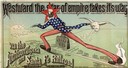
| Date: | 1886 |
|---|---|
| Description: | Advertisement for the Atchison, Topeka and Santa Fe Railroad featuring an illustration of Uncle Sam stretched from the Missouri River to the Pacific Ocean.... |

| Date: | 1886 |
|---|---|
| Description: | Bird's-eye map of Menomonee Falls. |

| Date: | 1872 |
|---|---|
| Description: | Bird's-eye map of Milwaukee on Lake Michigan. |

| Date: | 1874 |
|---|---|
| Description: | Bird's-eye map of Reedsburg, on the Baraboo River. |

| Date: | 1867 |
|---|---|
| Description: | Bird's-eye map of Ripon, with insets of points of interest. |

| Date: | 1883 |
|---|---|
| Description: | Bird's-eye map of Superior, county seat of Douglas County, on the shores of Lake Superior, with insets of points of interest. |

| Date: | 1867 |
|---|---|
| Description: | Bird's-eye map of Watertown on the Rock River, "drawn from nature." |

| Date: | 1857 |
|---|---|
| Description: | Elevated view of Waukesha with two women wearing dresses with a boy in long pants and tam o'shanter hat in foreground against a split-rail fence. Beyond th... |

| Date: | 1880 |
|---|---|
| Description: | Bird's-eye map of Waukesha, county seat of Waukesha County. |

| Date: | 1885 |
|---|---|
| Description: | Bird's-eye map of Waupun on the Rock River. There is an inset at top center of "Althouse, Wheeler & Co., Windmills and Pumps." |

| Date: | 1874 |
|---|---|
| Description: | Bird's-eye view of Beloit, with insets of Beloit College, Beloit High School, and Memorial Hall. |

| Date: | 1875 |
|---|---|
| Description: | Bird's-eye map of Black River Falls, looking southwest. |

| Date: | 1882 |
|---|---|
| Description: | This map of Cedarburg is a bird's-eye map with an inset of Cedarburg Brewery. Relief is shown pictorially and the map includes an index to buildings. |

| Date: | 1878 |
|---|---|
| Description: | Bird's-eye map of Chilton with insets of points of interest, including P.H. Becker's Brewery, Chilton House, and Gutheil's Block. |
If you didn't find the material you searched for, our Library Reference Staff can help.
Call our reference desk at 608-264-6535 or email us at: