Filter: Categories of Wisconsin Historical Images
Filter: Subject of Rivers
Filter: Year of 1800-1899
Filter: Subject of land
Filter: Categories of Wisconsin Historical Images
Filter: Subject of Rivers
Filter: Year of 1800-1899
Filter: Subject of land

| Date: | 1857 |
|---|---|
| Description: | A color-coded map of the Lake Superior region, including portions of Wisconsin, Minnesota and Michigan. |
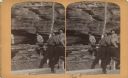
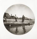
| Date: | 1886 |
|---|---|
| Description: | Stereograph of a group of men on a lumber raft holding a log vertical while other men push another log around it, creating a make-shift drill. |

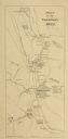
| Date: | 1837 |
|---|---|
| Description: | Map of the proposed route of the Milwaukee and Rock River Canal. |
| Date: | 10 1875 |
|---|---|
| Description: | Engraved view of the Dalles of the St. Louis River in Minnesota. |

| Date: | 1890 |
|---|---|
| Description: | This map shows lakes, railroads, and rivers. An explanation of railroad lines with mileage in Wisconsin and total mileage for 1890 is included. Portions of... |
| Date: | 05 06 1894 |
|---|---|
| Description: | Monongahela River view of a dam at Lock #2. |
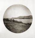
| Date: | 05 08 1894 |
|---|---|
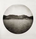
| Description: | View from the Ohio River of cultivated hillsides and houses near the shoreline. |
| Date: | 05 09 1894 |
|---|---|
| Description: | View upstream of the Ohio River from a lunching spot on a West Virginia bank. |
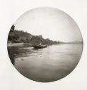
| Date: | 05 10 1894 |
|---|---|
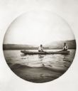
| Description: | Two fishermen in a boat on the Ohio River. |
| Date: | 05 11 1894 |
|---|---|
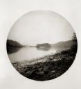
| Description: | View of Cresap's Bottom, looking toward the Ohio shore. |
| Date: | 05 12 1894 |
|---|---|
| Description: | Four boys stand on the shoreline of the Ohio River, seeing Reuben and Jessie Thwaites off. Buildings and a church steeple can be seen in the background. |
| Date: | 05 12 1894 |
|---|---|
| Description: | A woman rowing in a boat on the Ohio River. There is another boat on the shoreline behind her. |
| Date: | 05 12 1894 |
|---|---|
| Description: | View from the Ohio River of the West Virginia shoreline. |
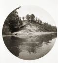
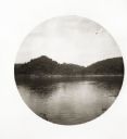
| Date: | 06 06 1894 |
|---|---|
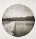
| Description: | A large hill on the Indiana shore, with ripples from a boat visible in the foreground. |
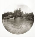
| Date: | 06 06 1894 |
|---|---|
| Description: | View from the river of fishermen's net and live-box at the shoreline. |

| Date: | 06 06 1894 |
|---|---|
| Description: | A view at the mouth of the Wabash River of a lone tree on what appears to be a peninsula. |

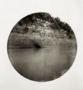
| Date: | 06 07 1894 |
|---|---|
| Description: | A large cave in the rock palisade along the river. An advertisement for St. Jacobs Oil is painted above the entrance to the cave. |

| Date: | 06 10 1894 |
|---|---|
| Description: | View of cows on the beach on the Illinois shore. |
If you didn't find the material you searched for, our Library Reference Staff can help.
Call our reference desk at 608-264-6535 or email us at: