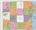
| Date: | 1987 |
|---|---|
| Description: | This 1987 map of Racine and Kenosha counties, Wisconsin, shows towns, sections, cities and villages, zip code boundaries, highways and roads, bicycle route... |

| Date: | 1907 |
|---|---|
| Description: | Shows roads, railroads, lakes, rivers, churches, and camps. |

| Date: | 1976 |
|---|---|
| Description: | Panel title. Shows railroads, roads, highways, boundaries, dams, public hunting and fishing grounds, cemeteries, forest ranger stations, plant life, and s... |

| Date: | 1940 |
|---|---|
| Description: | Shows Milwaukee and Waukesha counties, and parts of Dodge, Washington, Ozaukee, Jefferson, Walworth, and Racine counties. Includes indexes of "Cities, Town... |

| Date: | 1928 |
|---|---|
| Description: | Illustrated map of points of interest, including University buildings, parks, athletic venues, fraternity and sorority houses, and state buildings. |

| Date: | 1950 |
|---|---|
| Description: | Includes building index and "To Help You Locate Buildings" text. Index includes campus buildings and points of interest. Aerial view on verso. |

| Date: | 1968 |
|---|---|
| Description: | Shows potential fishing areas by species and season, as well as sand and rock bars, weed beds, public facilities, points of interest, and selected business... |

| Date: | 1990 |
|---|---|
| Description: | Map of bike routes in Madison. Lower right corner features a system map with legend. Upper left corner is an inset of the Capital Loop with labelled points... |

| Date: | 1927 |
|---|---|
| Description: | Map reads: "Now You Can Visualize Madison". Includes indexes, with points marked 1-98 and a key. Text and illustrations on verso include hotels and seasona... |
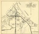
| Date: | 1932 |
|---|---|
| Description: | This map of Superior shows many points of interests including camping, fair grounds, docks, tourist attractions, lakes, roads, and waterways. |

| Date: | 1971 |
|---|---|
| Description: | This map of Nelson Dewey State Park shows the park layout, points of interest, facilities, campgrounds, roads, railroads, and the Mississippi River. Relief... |

| Date: | 1932 |
|---|---|
| Description: | This map of Granville shows streets, businesses, residential areas, schools, golf courses, and industrial areas. The map shows Granville in March of 1932. ... |

| Date: | 1970 |
|---|---|
| Description: | This map is intended for tourists of La Crosse. The cover features images of farms and natural land and reads: "friends are but strangers... we have yet to... |

| Date: | 1972 |
|---|---|
| Description: | This map of La Crosse is a plan for the city parks and recreation areas. The cover features an explanation of the Park and Recreation plan, objectives of t... |

| Date: | 1959 |
|---|---|
| Description: | This map of Lake Geneva has relief shown by contours and water depths shown by isolines. The map includes an index of schools, churches, public services, i... |

| Date: | 1800 |
|---|---|
| Description: | This map of the Little Kaukalin Region is ink on paper and shows Little Kaukalin Rapids, Black Bird Island, buildings, trails, meadows and woods, and a sug... |

| Date: | 1855 |
|---|---|
| Description: | This bird's-eye-view map of Madison is looking north across Lake Monona. The map features two women and two men on a lookout on top of a building in the fo... |
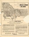
| Date: | 1920 |
|---|---|
| Description: | This map shows the Nakoma neighborhood in Madison including the "Proposed Golf Ground." The map reads: "Nakoma--the Suburb Superb." The map includes texts ... |
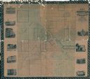
| Date: | 1860 |
|---|---|
| Description: | Map showing a plat of the city, land ownership by name, wards by number, local streets, buildings, fair grounds, nurseries, and part of Rock River. The map... |
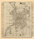
| Date: | 1955 |
|---|---|
| Description: | This map includes a street index and shows municipal golf course, parks, schools, cemeteries, Janesville County Club, and industrial sites. The back of the... |
If you didn't find the material you searched for, our Library Reference Staff can help.
Call our reference desk at 608-264-6535 or email us at: