 Filter: Categories of Wisconsin Historical Images
Filter: Subject of Recreation
Filter: Type of Map or Atlas
Filter: Subject of human settlements
Filter: Categories of Wisconsin Historical Images
Filter: Subject of Recreation
Filter: Type of Map or Atlas
Filter: Subject of human settlements

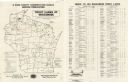
| Date: | 1867 |
|---|---|
| Description: | Bird's-eye map of Green Bay and Fort Howard, Brown Co., depicts street names and street layouts, houses, trees, and the East River. A reference key at the ... |

| Date: | 1882 |
|---|---|
| Description: | Bird's-eye map of Lake Geneva, looking southwest, with insets of points of interest. |

| Date: | 1870 |
|---|---|
| Description: | Bird's-eye view of Whitewater, with insets. |

| Date: | 1949 |
|---|---|
| Description: | Color bird's-eye map of the University of Wisconsin-Madison as it was midcentury, with two co-eds, several photographs of campus landmarks around edges, an... |

| Date: | 1892 |
|---|---|
| Description: | Bird's-eye view of the Columbian Exposition pavilions from the vantage point of Lake Michigan. Included is an inset of the Union Passenger Station (now Uni... |

| Date: | 1950 |
|---|---|
| Description: | Map showing buildings formerly used as Ringling Brothers Circus winter quarters, along with adjoining buildings. |

| Date: | 1920 |
|---|---|
| Description: | Map of the Nakoma neighborhood including the proposed golf grounds. |

| Date: | 1959 |
|---|---|
| Description: | University of Wisconsin-Madison campus. Numbers in circles identify buildings across campus with the building index. Black arrows point out important infor... |

| Date: | 1927 |
|---|---|
| Description: | Blueprint-style map of Frost Woods on the shore of Lake Monona. The map indicates the locations of Indian mounds, an Indian camp, and various plants. There... |

| Date: | 1925 |
|---|---|
| Description: | This brochure intended for tourists and shows resorts, lakes and railroads in northwestern Wisconsin and part of Michigan’s upper peninsula. Two inset maps... |

| Date: | 1925 |
|---|---|
| Description: | This map shows state trunk highways, county trunk highways, railroads, canoe trails, lakes, and free public camp sites. The map on the reverse also shows a... |

| Date: | 1968 |
|---|---|
| Description: | The map shows fire towers, public camp grounds, roads, snow mobile & riding trails, trout lakes, foot trails, railroads, and National Forest boundaries. |

| Date: | 1994 |
|---|---|
| Description: | This brochure presents a series of 16 maps of the Glacial Drumlin Trail and the New Berlin Trail. The Glacial Drumlin Trail consists of 53 miles of bike tr... |

| Date: | 1903 |
|---|---|
| Description: | A map of northern Wisconsin and Michigan showing the names and locations hunting and fishing resorts in the area, as well as location of Chicago and North ... |

| Date: | 1914 |
|---|---|
| Description: | Two maps of northern Wisconsin counties of Ashland, Barron, Bayfield, Chippewa, Douglas, Forest, Iron, Langlade, Lincoln, Oneida, Polk, Price, Sawyer, Tayl... |
| Date: | 1956 |
|---|---|
| Description: | A map that identifies the trout lakes in Wisconsin and their proximity to cities. Text on the page of the map highlights the conservation actions taken by ... |

| Date: | 1936 |
|---|---|
| Description: | This pictorial tourist map from the Wisconsin Conservation Commission depicts vacation activities and identifies tourist destinations throughout the state.... |

| Date: | 1975 |
|---|---|
| Description: | A tourist map of Grant County that displays the various activities and attractions found in the cities throughout the county, such as boat landings, fishin... |

| Date: | 1946 |
|---|---|
| Description: | A map showing the roads, railroads, towns, cities and villages, streams and lakes, airports, schools, churches, cemeteries, and golf courses in Kenosha Cou... |

| Date: | 1990 |
|---|---|
| Description: | A tourist map of Lafayette County, Wisconsin, that shows the locations of motels, camping, municipal parks, cheese factory tours, waysides, and golf course... |
If you didn't find the material you searched for, our Library Reference Staff can help.
Call our reference desk at 608-264-6535 or email us at: