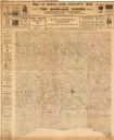
| Date: | 1903 |
|---|---|
| Description: | This map of Richland County, Wisconsin, shows land ownership and acreages, the township and range grid, sections, cities, towns and post offices, roads, ra... |

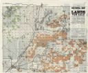
| Date: | |
|---|---|
| Description: | Map shows roads, railroads, rivers, and improved farms. Includes text on lands for sale and exchange by B.W. Pulling, successor to Marshfield Land Company.... |

| Date: | 1910 |
|---|---|
| Description: | Shows land for sale by Rusk Farm Co. in Rusk and Chippewa Counties, as well as farmhouses, roads, and railroads. |

| Date: | 1898 |
|---|---|
| Description: | This map of Duluth and Superior show lands that "will be for sale soon" in portions of Douglas County, Wisconsin and Saint Louis County, Minnesota. The map... |

| Date: | 1920 |
|---|---|
| Description: | This map shows lands owned by the American Immigration Company (red) and the Homeseekers Land Company (green). The map also shows highways, roads, railroad... |

| Date: | 1915 |
|---|---|
| Description: | This map shows roads, railroads, street railways, abandoned logging railroads, rural mail routes, telephone lines, schools, platted land, and state forest ... |
If you didn't find the material you searched for, our Library Reference Staff can help.
Call our reference desk at 608-264-6535 or email us at: