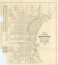
| Date: | 1878 |
|---|---|
| Description: | This map shows block numbers, wards, roads, railroads, parks, and selected buildings and includes a "Milwaukee city street guide" as well as a guide to pub... |
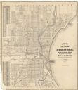
| Date: | 1887 |
|---|---|
| Description: | This map shows block numbers, roads, railroads, wards, and selected buildings. The map includes a "Milwaukee city street guide" and index to public buildin... |
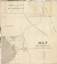
| Date: | 1860 |
|---|---|
| Description: | Map shows meadows, forests, buildings, railroad, and lots south of part of the city of Milwaukee. Relief shown by hachures. Includes list of lot acreages. |

| Date: | 1857 |
|---|---|
| Description: | This map shows lot and block numbers, wards, roads, railroads, some landowners’ names, and selected buildings. Lake Michigan, the Milwaukee River, and Glid... |

| Date: | 1857 |
|---|---|
| Description: | This map shows lot and block numbers, wards, roads, railroads, some landowners’ names, and selected buildings. Lake Michigan, the Milwaukee River, and Glid... |

| Date: | 1868 |
|---|---|
| Description: | This map shows lot and block numbers, some property ownership, wards, roads, and railroads. An inset map shows the Glidden & Lockwood’s addition. There are... |

| Date: | 1869 |
|---|---|
| Description: | This map shows lot and block numbers, some property ownership, wards, roads, and railroads and includes inset map of Glidden & Lockwood’s addition. There a... |
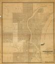
| Date: | 1846 |
|---|---|
| Description: | This map shows lot and block numbers, roads, railroads, and some landowners’ names and includes the manuscript annotations: "From the Lapham collection" --... |
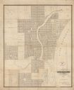
| Date: | 1845 |
|---|---|
| Description: | This map shows lot and block numbers, local streets, railroads, some landowners’ names, Milwaukee River, Menomonee River, and part of Lake Michigan. The ma... |
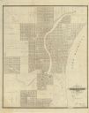
| Date: | 1846 |
|---|---|
| Description: | This map shows lot and block numbers, local streets, railroads, some landowners’ names, Milwaukee River, Menomonee River, and part of Lake Michigan. The ma... |

| Date: | 1847 |
|---|---|
| Description: | This map shows lot and block numbers, roads, railroads, and some landowners’ names. Lake Michigan, the Milwaukee River, and the Menomonee River are labeled... |

| Date: | 1880 |
|---|---|
| Description: | This map shows wards, roads, railroads, lot and block numbers, subdivisions, parks, and some landownership. A handwritten annotation in red reads: "Note: S... |

| Date: | 1956 |
|---|---|
| Description: | This map shows city, suburban, parochial and other types schools, with an explanation of symbols in the right margin. The original caption for the map read... |

| Date: | 1966 |
|---|---|
| Description: | This map shows city, suburban, parochial and other types schools, with an explanation of symbols in the right margin. The original caption for the map read... |
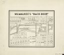
| Date: | 1940 |
|---|---|
| Description: | This map is pen and ink on paper and is map 9 in a series of 12. The map shows streets and railroad lines. |
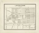
| Date: | 1940 |
|---|---|
| Description: | This map is pen and ink on paper and is map 10 in a series of 12. The map shows streets and railroad lines. |

| Date: | 1940 |
|---|---|
| Description: | This map is pen and ink on paper and is map 12 in a series of 12. The map shows streets, railroad lines, the Kinnickinnic River, and Lake Michigan. |
If you didn't find the material you searched for, our Library Reference Staff can help.
Call our reference desk at 608-264-6535 or email us at: