| Date: | 1890 |
|---|---|
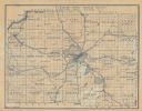
| Description: | Shows towns of Dane County, lakes, rivers, and railroads. Relief shown by hachures. Includes color illustration of Madison and text describing Dane County ... |

| Date: | 1899 |
|---|---|
| Description: | These two maps of Madison and the Four Lakes region show the site of the Teachers Country Club on Lake Monona, the lakes and the Catfish or Yahara River, f... |

| Date: | 1909 |
|---|---|
| Description: | This 1909 bird's-eye view of Madison and the surrounding Four Lakes region shows roads, railroads, selected buildings in Madison, and points of interest ar... |

| Date: | 1890 |
|---|---|
| Description: | This late-19th century map of Dane County, Wisconsin, shows the township and range grid, towns, sections, cities and villages, lakes and streams, roads, an... |

| Date: | 1898 |
|---|---|
| Description: | This map shows the contour depths of Delavan Lake and the Lauderdale Lakes in Walworth County, Wisconsin, and includes nine cross sections of the lakes. Ro... |

| Date: | 1911 |
|---|---|
| Description: | This map, taken from the 1911 Map of Wisconsin showing geology and roads by Hotchkiss and Thwaites, shows the northwest portion of Douglas County, Wisconsi... |

| Date: | 1890 |
|---|---|
| Description: | This map of Douglas County, Wisconsin, published around the beginning of the 20th century shows the copper bearing formations in the county on a map that a... |

| Date: | 1953 |
|---|---|
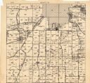
| Description: | Map shows landownership and acreages, roads, and railroads in the Town of Waukesha and part of the city of Waukesha, Waukesha County, Wisconsin. |

| Date: | 1930 |
|---|---|
| Description: | This pictorial map from the first half of the 20th century shows the landmarks, highways, rail lines, and cities and villages in the vicinity of the Wiscon... |

| Date: | 1910 |
|---|---|
| Description: | This early 20th century map of Wood County, Wisconsin, shows the township and range grid, towns, sections, cities and villages, roads and railroads, and st... |

| Date: | 1898 |
|---|---|
| Description: | This 1896 map of the Chain-O-Lakes region of Waupaca County, Wisconsin, shows the lakes and streams, some topography, archaeological sites, roads, railroad... |

| Date: | 1900 |
|---|---|
| Description: | This 1900 map of Waukesha County, Wisconsin, shows the township and range grid, towns, sections, cities and villages, rural landowners and acreages, railro... |

| Date: | |
|---|---|
| Description: | Map shows roads, railroads, rivers, and improved farms. Includes text on lands for sale and exchange by B.W. Pulling, successor to Marshfield Land Company.... |

| Date: | 1854 |
|---|---|
| Description: | Shows street grid, sections in adjacent townships, routes of railroads and projected railroads, post offices, and creeks. Table of references identifies ma... |

| Date: | 1910 |
|---|---|
| Description: | This map from around 1916 shows the Soo Line railroad lines on a soil map of the state of Wisconsin. The map on the verso shows the township and range grid... |

| Date: | 1910 |
|---|---|
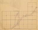
| Description: | This map is ink on paper. Shows Bruce’s proposed railway route and Moon’s railroad survey route along the Flambeau River, in parts of Lake and Eisenstein t... |

| Date: | 1947 |
|---|---|
| Description: | Shows lot and block numbers, 28 points of interest in the upper left that correspond to numbers on the map, and landownership with acreages. "Erickson Brot... |

| Date: | 05 1958 |
|---|---|
| Description: | Photocopy of a map created by the City of Milwaukee Master Plan Program City Planning Division in May of 1958 representing 1870 "THE CENTRAL AREA OF THE CI... |

| Date: | 1900 |
|---|---|
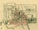
| Description: | Pen and pencil on tracing paper. Shows landownership by name, local streets, local businesses, mill pond, creek, and proposed railroad. |

| Date: | 1872 |
|---|---|
| Description: | Shows landowners, buildings, lot numbers, roads and railroads. Includes Menasha business directory. |
If you didn't find the material you searched for, our Library Reference Staff can help.
Call our reference desk at 608-264-6535 or email us at: