Filter: Categories of Wisconsin Historical Images
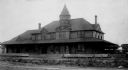
Filter: Subject of Railroads
Filter: Creator Name of Unknown
Filter: Community of Superior
Filter: Categories of Wisconsin Historical Images
Filter: Subject of Railroads
Filter: Creator Name of Unknown
Filter: Community of Superior

| Date: | 1885 |
|---|---|
| Description: | Illustrated view of Superior, as well as Omaha, Kansas City, St. Paul, and Winnipeg. Caption reads: "Superior - The Last Possible Great Marine City in the ... |

| Date: | 1911 |
|---|---|
| Description: | This map, taken from the 1911 Map of Wisconsin showing geology and roads by Hotchkiss and Thwaites, shows the northwest portion of Douglas County, Wisconsi... |

| Date: | 1890 |
|---|---|
| Description: | This map of Superior shows labeled streets, railroads, docks, city wards, and the state line. Relief is shown by hachures. Below the title reads: "Bedford ... |

| Date: | 1951 |
|---|---|
| Description: | This map of Superior shows labeled streets, waterways, railroads, and company ownership of docks. |

| Date: | 1891 |
|---|---|
| Description: | This colorful map shows additions, railroads, docks, streets, established dock lines, marshes, and proposed belt line railroad. The map covers west and sou... |

| Date: | 1900 |
|---|---|
| Description: | This map shows streets, railroads, dock and harbor lines, and parks. The map includes population tables for 1880, 1890, 1900. |

| Date: | 1966 |
|---|---|
| Description: | This blue line print shows existing and proposed streets, docks, company-owned land, railroads and railroad yards, parks, and municipal airport. |
If you didn't find the material you searched for, our Library Reference Staff can help.
Call our reference desk at 608-264-6535 or email us at: