| Date: | |
|---|---|
| Description: | Elevated general view of the city with harbor and mountains. A ship is docked near the railroad bridge. |

| Date: | 1950 |
|---|---|
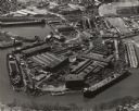
| Description: | Aerial view showing shipyards, rivers and roads. |

| Date: | 1875 |
|---|---|
| Description: | The City of Fort Howard, Brown County, Wisconsin. Compiled from the records and drawn by F.E. Predergast, of De Pere. |

| Date: | |
|---|---|
| Description: | Elevated panoramic view of the city of Madison, with the Wisconsin State Capitol and Lake Monona on the far left, and Picnic Point and Lake Mendota on the ... |
If you didn't find the material you searched for, our Library Reference Staff can help.
Call our reference desk at 608-264-6535 or email us at: