Filter: Categories of Wisconsin Historical Images
Filter: Subject of Railroad bridges
Filter: Subject of roads
Filter: Subject of water
Filter: Categories of Wisconsin Historical Images
Filter: Subject of Railroad bridges
Filter: Subject of roads
Filter: Subject of water

| Date: | 1896 |
|---|---|
| Description: | Bird's-eye map of Darlington. Area bordered by Washington and North Streets, upper left hand corner, the fairgrounds, upper right corner, River Street, bot... |

| Date: | 1870 |
|---|---|
| Description: | Bird's-eye map of Kilbourn City, now known as Wisconsin Dells. Kilbourn City was platted in the 1850s and received a boost when the La Crosse and Milwaukee... |

| Date: | 1883 |
|---|---|
| Description: | Bird's-eye map of Prairie du Sac, Wisconsin with an inset of Clifton. |

| Date: | 1891 |
|---|---|
| Description: | Bird's-eye map of Stevens Point, looking east, with an inset of the Water Works. Wisconsin River in foreground with fifty-three business locations identifi... |

| Date: | 1879 |
|---|---|
| Description: | Bird's-eye map of Two Rivers. |

| Date: | 1930 |
|---|---|
| Description: | Aerial view of the city and the river. |

| Date: | 1930 |
|---|---|
| Description: | Aerial view of city, with Eau Claire River is in the foreground with Milwaukee railroad bridge at left. Gillette Rubber Co. plant is in center with Omaha r... |
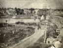
| Date: | 1886 |
|---|---|
| Description: | View of the Chicago, Burlington, and Quincy railroad drawbridge and trestle. |

| Date: | 1950 |
|---|---|
| Description: | Looking south. Bridge in foreground is over Kinnickinnic River. Bridge over the road holds railroad tracks. In background are several houses and a build... |

| Date: | 1944 |
|---|---|
| Description: | Aerial view of the U.S. Rubber Company plant and surrounding environment. |

| Date: | |
|---|---|
| Description: | "Cows graze along the Rock River. In the distance is North Pole Road and beyond that tracks of the Soo Line Railroad." |

| Date: | |
|---|---|
| Description: | View from shoreline over river of men posed standing on a railroad bridge under construction during the winter. |

| Date: | |
|---|---|
| Description: | Elevated view over buildings of men and women walking across a bridge over a high river. There is a railroad bridge in the background. |

| Date: | |
|---|---|
| Description: | View across a frozen river towards a railroad bridge. A group of men are standing on top of the bridge in the center, and two other men are on the left. |

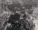
| Date: | 1950 |
|---|---|
| Description: | Text on front reads: "Horseshoe Curve At Rock Springs, Wis." A road and a railroad track, with bridges over the Baraboo River, make a double curve in an el... |

| Date: | 1911 |
|---|---|
| Description: | Text on front reads: "Sheboygan River and Belt Line Bridge, Sheboygan, Wis." Elevated view of a trestle bridge over the river. Two bridges cross the river... |
If you didn't find the material you searched for, our Library Reference Staff can help.
Call our reference desk at 608-264-6535 or email us at: