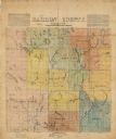
| Date: | 1871 |
|---|---|
| Description: | This map of Barron County, Wisconsin, shows the township and range grid, towns, sections, cities and villages, post offices, dwellings, schools, roads, swa... |

| Date: | 1877 |
|---|---|
| Description: | This 1877 map of Trempealeau County, Wisconsin, shows the township and range grid, sections, towns, cities and villages, land ownership and acreages, roads... |

| Date: | 1878 |
|---|---|
| Description: | This 1878 map of Vernon County, Wisconsin, shows the township and range grid, sections, towns, cities and villages, land ownership and acreages, roads, rai... |
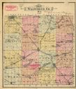
| Date: | 1896 |
|---|---|
| Description: | This late 19th century map of Walworth County, Wisconsin, shows the township and range grid, towns, sections, villages and post offices, roads, railroads, ... |
| Date: | 1870 |
|---|---|
| Description: | This 1870 map of Brown County, Wisconsin, shows the township and range grid, towns, sections, cities, villages and post offices, land ownership, roads, rai... |

| Date: | 1896 |
|---|---|
| Description: | This map of Brown County, Wisconsin, from the late 19th century shows land claims along the Fox River, the township and range grid, towns, sections, cities... |
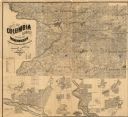
| Date: | 1861 |
|---|---|
| Description: | This 1861 map of Columbia County, Wisconsin, shows the township and range grid, towns, sections, cities and villages, railroads, roads, property owners and... |
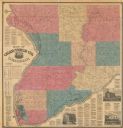
| Date: | 1878 |
|---|---|
| Description: | This map of Crawford County, Wisconsin, shows the township and range grid, sections, towns, cities and villages, land ownership and acreages, roads, railro... |

| Date: | 1854 |
|---|---|
| Description: | This mid-19th century map of Dane County, Wisconsin, shows the township and range grid, towns, sections, cities, villages and post offices, lakes and strea... |

| Date: | 1896 |
|---|---|
| Description: | This late 19th-century map of Dodge County, Wisconsin, shows the township and range grid, towns, sections, cities, villages and post offices, some property... |

| Date: | 1899 |
|---|---|
| Description: | This 1899 map of Douglas County, Wisconsin, shows the township and range grid, towns, sections, cities, villages and railroad stations, mines, roads, railr... |
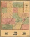
| Date: | 1878 |
|---|---|
| Description: | This 1878 map of Wood County, Wisconsin, shows the township and range grid, towns, sections, cities, villages and post offices, landownership, roads, railr... |
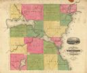
| Date: | 1855 |
|---|---|
| Description: | This 1855 map of Winnebago County, Wisconsin, shows the township and range grid, towns, cities, villages, and post offices, roads, and lakes and streams. |

| Date: | 1854 |
|---|---|
| Description: | Shows street grid, sections in adjacent townships, routes of railroads and projected railroads, post offices, and creeks. Table of references identifies ma... |
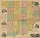
| Date: | 09 1893 |
|---|---|
| Description: | Shows townships and sections, landownership and acreages, buildings, and school districts. Includes vignettes of local buildings, business directory, list ... |

| Date: | 1896 |
|---|---|
| Description: | This 1896 map of Douglas County, Wisconsin, shows the township and range grid, the towns of Superior, Brule, Gordon, and Nebagamain, sections, cities and v... |
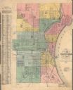
| Date: | 1880 |
|---|---|
| Description: | Map created from original drawing and surveys taken by Silas Chapman. Bottom right corner features a reference key. There is a street guide on the left sid... |
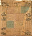
| Date: | 1876 |
|---|---|
| Description: | Map shows townships and sections, landownership and acreages, roads, railroads, post offices, and farms. Sections appear in pink, yellow, and blue. On the ... |

| Date: | 1886 |
|---|---|
| Description: | Map shows townships, post offices, roads, railroads, and selected buildings. The sections are in pink, green, blue, and yellow. Counties, towns, and lakes ... |

| Date: | 1871 |
|---|---|
| Description: | Map created between 1871 and 1880. Shows townships, post offices, a possible railroad to Penoka Iron Range, and the North Wisconsin Railroad. |
If you didn't find the material you searched for, our Library Reference Staff can help.
Call our reference desk at 608-264-6535 or email us at: