 Filter: Categories of Wisconsin Historical Images
Filter: Subject of Postal service
Filter: Type of Map or Atlas
Filter: Categories of Wisconsin Historical Images
Filter: Subject of Postal service
Filter: Type of Map or Atlas

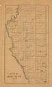
| Date: | 1877 |
|---|---|
| Description: | This 1877 map of Trempealeau County, Wisconsin, shows the township and range grid, sections, towns, cities and villages, land ownership and acreages, roads... |

| Date: | 1878 |
|---|---|
| Description: | This 1878 map of Vernon County, Wisconsin, shows the township and range grid, sections, towns, cities and villages, land ownership and acreages, roads, rai... |

| Date: | 1896 |
|---|---|
| Description: | This late 19th century map of Walworth County, Wisconsin, shows the township and range grid, towns, sections, villages and post offices, roads, railroads, ... |

| Date: | 1909 |
|---|---|
| Description: | This 1909 revision of Harmon's 1896 map of Washburn County, Wisconsin, shows the township and range grid, towns, sections, schools, wagon roads, cities and... |

| Date: | 1916 |
|---|---|
| Description: | This 1916 map of Washburn County, Wisconsin, shows the township and range grid, sections, towns, schools, wagon roads, cities and villages, post offices, s... |
| Date: | 1900 |
|---|---|
| Description: | This map of Adams County, Wisconsin, from E.B. Foote's Plat book of Adams County, Wisconsin, 1900, shows the township and range grid, towns, sections, citi... |

| Date: | 1906 |
|---|---|
| Description: | This 1906 map of Bayfield County, Wisconsin, shows towns, sections, cities, villages and post offices, land ownership, wagon roads, railroads, schools, gov... |

| Date: | 1870 |
|---|---|
| Description: | This 1870 map of Brown County, Wisconsin, shows the township and range grid, towns, sections, cities, villages and post offices, land ownership, roads, rai... |

| Date: | 1896 |
|---|---|
| Description: | This map of Brown County, Wisconsin, from the late 19th century shows land claims along the Fox River, the township and range grid, towns, sections, cities... |

| Date: | 1861 |
|---|---|
| Description: | This 1861 map of Columbia County, Wisconsin, shows the township and range grid, towns, sections, cities and villages, railroads, roads, property owners and... |

| Date: | 1878 |
|---|---|
| Description: | This map of Crawford County, Wisconsin, shows the township and range grid, sections, towns, cities and villages, land ownership and acreages, roads, railro... |

| Date: | 1907 |
|---|---|
| Description: | Shows post offices, railroads, country clubs, and land ownership by name. |

| Date: | 1854 |
|---|---|
| Description: | This mid-19th century map of Dane County, Wisconsin, shows the township and range grid, towns, sections, cities, villages and post offices, lakes and strea... |

| Date: | 1896 |
|---|---|
| Description: | This late 19th-century map of Dodge County, Wisconsin, shows the township and range grid, towns, sections, cities, villages and post offices, some property... |

| Date: | 1943 |
|---|---|
| Description: | This 1943 map of Door County, Wisconsin, identifies the post offices and rural routes in the county. Highways and roads, cities and villages, and rural res... |

| Date: | 1899 |
|---|---|
| Description: | This 1899 map of Douglas County, Wisconsin, shows the township and range grid, towns, sections, cities, villages and railroad stations, mines, roads, railr... |

| Date: | 1878 |
|---|---|
| Description: | This 1878 map of Wood County, Wisconsin, shows the township and range grid, towns, sections, cities, villages and post offices, landownership, roads, railr... |

| Date: | 1903 |
|---|---|
| Description: | Map of Brown County, Wisconsin, shows the township and range grid, towns, sections, cities, villages and post offices, land owners and acreages, railroads,... |

| Date: | 1901 |
|---|---|
| Description: | Map shows lakes, rivers, schools, saw mills, post offices, creameries, and churches. Includes significant manuscript annotations showing township divisions... |

| Date: | 1902 |
|---|---|
| Description: | This 1902 map of Chippewa County, Wisconsin, shows the township and range grid, towns, sections, cities, villages and post offices, land ownership and acre... |
If you didn't find the material you searched for, our Library Reference Staff can help.
Call our reference desk at 608-264-6535 or email us at: