 Filter: Categories of Wisconsin Historical Images
Filter: Subject of Piers
Filter: Year of 1800-1899
Filter: Categories of Wisconsin Historical Images
Filter: Subject of Piers
Filter: Year of 1800-1899

| Date: | 1891 |
|---|---|
| Description: | Photograph of a painting by May Conniff Frost showing the tugboat Record of the Inman Line pulling a lake schooner through rough waters into Superio... |

| Date: | 1875 |
|---|---|
| Description: | Elevated view over De Pere. In the foreground is the De Pere News Office and Post Office building. Behind it people are walking on the bridge over the Fox ... |

| Date: | 1895 |
|---|---|
| Description: | Seven men, standing informally, some wearing “yachting caps”, on a dock, presumably in Sturgeon Bay, Wis. |
| Date: | 1872 |
|---|---|
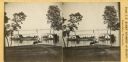
| Description: | View from shoreline towards two small sidewheel steam launches on Lake Monona. The sign on the steam launch on the left side of the pier reads: "Scutanawbe... |
| Date: | 1892 |
|---|---|
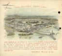
| Description: | Back cover of calendar, with the text: "Hail Columbia, Happy Land!" Features a bird's-eye illustration of the 1893 World's Columbian Exposition (World's Fa... |
| Date: | 1856 |
|---|---|
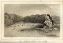
| Description: | Lithographic view of the Grande Chute Falls on the Fox River. There is a tent on the shore on the right. |

| Date: | 08 27 1896 |
|---|---|
| Description: | View from rocky shoreline of Turvill's new sailboat tied to a dock. A women is standing on the narrow wooden dock. A man is standing in the sailboat, with ... |
| Date: | 07 28 1896 |
|---|---|
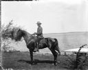
| Description: | Outdoor portrait of Mr. Olin sitting on a horse on a lawn near the shoreline of a lake. The far shoreline is in the background. Near the shoreline on the r... |

| Date: | 1896 |
|---|---|
| Description: | View from sloped lawn of the Lake Mendota shoreline, with the Olin boathouse in the foreground, and the University of Wisconsin-Madison boathouse on the ri... |

| Date: | 12 1895 |
|---|---|
| Description: | A northeast view of Madison from University Pier. |

| Date: | 1861 |
|---|---|
| Description: | This map shows lot and block numbers, piers, streets, monuments, and township section corners. Included is a note on the width of avenues, piers, slips, al... |
| Date: | 1890 |
|---|---|
| Description: | Elevated view from shoreline of two side wheeled steamboats, the "Lucius Newberry," left, and the "Lady of the Lake," docked at Geneva Lake. Other smaller ... |

| Date: | 07 19 1854 |
|---|---|
| Description: | This map shows the shore in 1844, 1850, and 1852, the length of and proposed additions to the pier. Relief is shown by hachures and depths are shown by sou... |

| Date: | 07 19 1854 |
|---|---|
| Description: | This hand-colored map shows the North and South Pier, the North Pier Bridge, the present Channel, and the Channel to be dredged. Lake Michigan and a light ... |

| Date: | 1857 |
|---|---|
| Description: | This map with north oriented toward the lower left shows the United States North and South Piers. Lake shores from 1855, 1856, and 1857 are labeled. Depths... |

| Date: | 09 1853 |
|---|---|
| Description: | This map shows streets, docks, warehouses, and piers near the harbor. The Manitowoc River and Lake Michigan are labeled. Depths are indicated by soundings ... |

| Date: | 1854 |
|---|---|
| Description: | This map shows streets, docks, warehouses, and piers near the harbor. Relief is shown by hachures and depths are shown by soundings and isolines. Lake Mich... |

| Date: | 1856 |
|---|---|
| Description: | This map shows streets, piers, and wharves. Lake Michigan, the Manitowoc River, and select buildings are labeled. Relief is shown by hachures and sounding... |

| Date: | 1865 |
|---|---|
| Description: | This map shows the river shore and piers. Lake Michigan is labeled. Depths are shown by soundings and isolines. The bottom margin includes notes on soundi... |

| Date: | 1874 |
|---|---|
| Description: | This map shows piers, streets, the Manitowoc River and shore lines of 1856, 1869, 1873 and 1874. The top margin reads; "Soundings taken 1974." Written in i... |
If you didn't find the material you searched for, our Library Reference Staff can help.
Call our reference desk at 608-264-6535 or email us at: