| Date: | 1965 |
|---|---|
| Description: | This map shows streets, churches, schools, wards, railroads, parks and fields, cemeteries, Historical Museum, Yacht Basin & Marina, and Marinette General H... |

| Date: | 2000 |
|---|---|
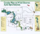
| Description: | This map shows Wisconsin Public Service Corporation property, special regulation areas, public boat landings, roads, parks, and other recreation areas. Ins... |

| Date: | |
|---|---|
| Description: | View over large rocks towards the Peshtigo River in Goodman Park. |

| Date: | |
|---|---|
| Description: | View of a bandstand at a park. A band is playing, and people are gathered on the grounds of the park. Caption reads: "Band Stand, Lakeside Park, Marinette,... |
If you didn't find the material you searched for, our Library Reference Staff can help.
Call our reference desk at 608-264-6535 or email us at: