 Filter: Categories of Wisconsin Historical Images
Filter: Subject of Parks
Filter: County of Chippewa
Filter: Type of Map or Atlas
Filter: Categories of Wisconsin Historical Images
Filter: Subject of Parks
Filter: County of Chippewa
Filter: Type of Map or Atlas

| Date: | 1951 |
|---|---|
| Description: | This map of Chippewa Falls shows the city of Chippewa River, city limits, roads, highways, fair grounds, and parks. |

| Date: | 1938 |
|---|---|
| Description: | This map shows plat of town, land ownership by name, city limits, section boundaries, wards, local roads, railroads, parks, fairgrounds, cemeteries, locati... |

| Date: | 1975 |
|---|---|
| Description: | This standard U.S.G.S. topographic map was annotated by civil engineer and railroad historian James P. Kaysen to show the location of existing and defunct ... |
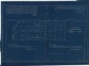
| Date: | 11 1925 |
|---|---|
| Description: | This blueprint manuscript map shows an addition. The map was surveyed and platted for B.G. Proctor, president, and George Peterson, secretary, of the Corne... |
If you didn't find the material you searched for, our Library Reference Staff can help.
Call our reference desk at 608-264-6535 or email us at: