 Filter: Categories of Wisconsin Historical Images
Filter: Subject of Parks
Filter: Type of Map or Atlas
Filter: Categories of Wisconsin Historical Images
Filter: Subject of Parks
Filter: Type of Map or Atlas
| Date: | 1929 |
|---|---|
| Description: | This map shows streets, railroads, parks, cemeteries, and a proposed harbor. The top margin includes an advertisement for Delco Motor Oil and the right mar... |

| Date: | 1930 |
|---|---|
| Description: | This map shows streets, railways, bus lines, railroads, roads, parks, cemeteries, Lake Michigan, and a proposed harbor. Also included is a legend and on th... |

| Date: | 1974 |
|---|---|
| Description: | This map shows streets, Lake Winnebago, Little Lake Butte Des Morts, and the Fox River. Also included is text on the Fox River Waterways and the history of... |

| Date: | 1894 |
|---|---|
| Description: | This map shows sewers, intercepting sewers, manholes, block numbers, streets, railroads, parks, cemeteries, and Lake Michigan. The right margin reads: "Tot... |

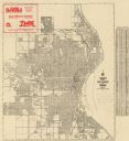
| Date: | 1896 |
|---|---|
| Description: | This map shows streets, wards, railroads, parks, cemeteries, and Lake Michigan. Also included are explanations and an index of points of interest. |

| Date: | 1897 |
|---|---|
| Description: | Two maps that show cemeteries, schools, engine houses, railroads, street railways, wards, roads, parks, block numbers, and Lake Michigan. One map has wards... |

| Date: | 1879 |
|---|---|
| Description: | This map shows asylums, cemeteries, hospitals, parks, streets, and wards. Relief is shown by contours. Also included are manuscript annotations in pencil. ... |

| Date: | 1890 |
|---|---|
| Description: | This map shows city wards, block numbers, parks, cemeteries, roads, railroads, and selected buildings. The map includes indexes to streets, public building... |

| Date: | 1939 |
|---|---|
| Description: | This illustrated map shows counties, highways, rivers, roads, present and proposed state parks and forests, proposed state parkways, proposed state monumen... |

| Date: | 1921 |
|---|---|
| Description: | This map shows counties, roads, Lake Superior, Lake Michigan, and portions of surrounding states. Included is an index to cities, villages and other places... |

| Date: | 1992 |
|---|---|
| Description: | This guide features a map of suggested bike routes. Also included is a legend, text on how to use the map and legend, points of interest, safety tips, and ... |

| Date: | 10 1911 |
|---|---|
| Description: | This map shows lot numbers, building lines, roads, trees, and Indian mounds. Relief is shown by contours. Includes manuscript annotations marking parks. |

| Date: | 1996 |
|---|---|
| Description: | This map shows roads, lakes, points of interest including colleges, trails, historic communities and sites, museums, and parks. Also included are descripti... |

| Date: | 1921 |
|---|---|
| Description: | This map shows various zones in a proposed city ordinance. Also shown are creeks, streets, parks, hospitals, cemeteries, and the Fox River. A legend is inc... |

| Date: | 1872 |
|---|---|
| Description: | This map shows wards, roads, railroads, lot and block numbers, subdivisions, parks, some landownership, and a race course. Manuscript annotations in red in... |

| Date: | 1880 |
|---|---|
| Description: | This map shows wards, roads, railroads, lot and block numbers, subdivisions, parks, and some landownership. A handwritten annotation in red reads: "Note: S... |

| Date: | 1947 |
|---|---|
| Description: | This map shows various types of forests, nurseries, state fish hatcheries, major wood-using industries, camp & picnic grounds, fire towers, ranger stations... |

| Date: | 1919 |
|---|---|
| Description: | Narrow red lines show principal secondary highways. Green circles shows points of historical interest. Green triangles show Indian mounds and Indian villag... |

| Date: | 1933 |
|---|---|
| Description: | This map shows the state trunk highway system and county trunk highways. This map show surface type on state and county trunk highways and the locations of... |
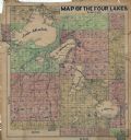
| Date: | 1911 |
|---|---|
| Description: | This hand-colored map shows landownership, rural dwellings, parks, roads, and railroads. Lake Mendota, Monona, Waubesa, and Kegonsa are labeled. |
If you didn't find the material you searched for, our Library Reference Staff can help.
Call our reference desk at 608-264-6535 or email us at: