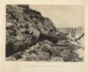
| Date: | 1866 |
|---|---|
| Description: | Exterior of Fort Sumter. A cannon has fallen on the steep shoreline and waves are hitting the rocks. Plate 58 |

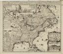
| Date: | 1719 |
|---|---|
| Description: | This extremely detailed and ornate map shows the cities, Native American land, mountains, lakes, rivers, and European claims of North America. An inset map... |
If you didn't find the material you searched for, our Library Reference Staff can help.
Call our reference desk at 608-264-6535 or email us at: