 Filter: Categories of Wisconsin Historical Images
Filter: Subject of Ocean
Filter: Subject of children and adults
Filter: Subject of islands
Filter: Categories of Wisconsin Historical Images
Filter: Subject of Ocean
Filter: Subject of children and adults
Filter: Subject of islands
| Date: | |
|---|---|
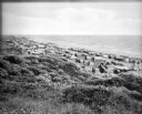
| Description: | Tents line a beach along the Atlantic Ocean. Foliage covers the foreground and several people and vehicles can be seen throughout the camp. |

| Date: | 1630 |
|---|---|
| Description: | One of the few maps by Dutch cartographer Willem Blaeu depicting the Americas, this map shows regions, settlements, islands, mountains, forests, rivers, an... |

| Date: | 1733 |
|---|---|
| Description: | This map of North America shows settlements, rivers, lakes, Native American land, trade winds, and numerous topographical features such as forests and moun... |
If you didn't find the material you searched for, our Library Reference Staff can help.
Call our reference desk at 608-264-6535 or email us at: