Filter: Categories of Wisconsin Historical Images
Filter: Subject of Ocean
Filter: Type of Map or Atlas
Filter: Categories of Wisconsin Historical Images
Filter: Subject of Ocean
Filter: Type of Map or Atlas
| Date: | 1610 |
|---|---|
| Description: | A map of New France, including parts of the United States and Canada, to illustrate the Jesuit relations and allied documents. |
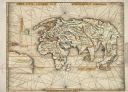
| Date: | 1513 |
|---|---|
| Description: | This exquisite woodcut map is one of the first to show any part of North America. It originally appeared in the 1513 Strasbourg edition of Ptolemy's Geogra... |
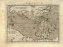
| Date: | 1576 |
|---|---|
| Description: | Map of America. This is the oldest map in the Parker collection. It is based on the geography of Ortelius, who is considered to be the creator of the first... |

| Date: | 1698 |
|---|---|
| Description: | Copperplate engraving. Scale [ca. 1:11,500,00]. |

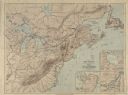
| Date: | 1744 |
|---|---|
| Description: | Paris: 1744. W 92⁰--W 76⁰/N 49⁰--N 41⁰. Scale [ca. 1:4,000,000] |
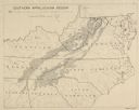
| Date: | |
|---|---|
| Description: | "Non-agricultural land in southern Appalachian Mountains" |

| Date: | 1861 |
|---|---|
| Description: | A general map of Pennsylvania, Virginia, New Jersey and Delaware. Insets include maps of New Orleans, Baltimore, St. Louis, Charleston, Savannah, Washingto... |

| Date: | 1865 |
|---|---|
| Description: | This map of Maryland and Virginia shows railroads, rivers, cities and towns, and the positions of Confederate troops and defenses in Virginia in 1861. |

| Date: | 1860 |
|---|---|
| Description: | This colored map shows railroad lines east of the Mississippi as well as in the states bordering the Mississippi River. The Great Lakes and Gulf of Mexico ... |

| Date: | 1778 |
|---|---|
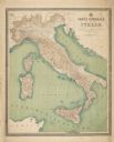
| Description: | This Italian map from 1778 depicts the upper portion of the Old Northwest. Rivers and lakes are identified and relief, real and imagined, is depicted picto... |

| Date: | 1862 |
|---|---|
| Description: | This map of the southeastern United States shows cities and towns, rail lines, and geographic features such as rivers, mountains, lakes, and swamps. |

| Date: | 1862 |
|---|---|
| Description: | This map of the southeastern United States shows forts and battlefields, railroads, rivers, and cities and towns. Dates of admission and secession of the s... |

| Date: | 1863 |
|---|---|
| Description: | A general map of the southeastern United States showing Missouri, Kentucky, West Virginia, Virginia, North Carolina, South Carolina, Georgia, Florida, Alab... |
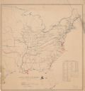
| Date: | |
|---|---|
| Description: | Map of the eastern United States that illustrates the limits of the "loyal states" as of July 1861 in red, the territory controlled by United States forces... |

| Date: | 1899 |
|---|---|
| Description: | A map showing the shoreline of a portion of El Montecito, Santa Barbara County, California. The map shows properties along the Pacific Ocean, and may have ... |

| Date: | 1868 |
|---|---|
| Description: | Map showing the northern water routes between Mississippi River and Atlantic Ocean Relief shown by hachures. Includes Profile of the Erie Canal, table of ... |

| Date: | 1625 |
|---|---|
| Description: | An illustrated map of the world with captions in Latin. Illustrations include depictions of the seasons and the elements. |
If you didn't find the material you searched for, our Library Reference Staff can help.
Call our reference desk at 608-264-6535 or email us at: