 Filter: Categories of Wisconsin Historical Images
Filter: Subject of Neighborhoods
Filter: Type of Map or Atlas
Filter: Year of 1900-1999
Filter: Year of 1940-1949
Filter: Categories of Wisconsin Historical Images
Filter: Subject of Neighborhoods
Filter: Type of Map or Atlas
Filter: Year of 1900-1999
Filter: Year of 1940-1949

| Date: | 1940 |
|---|---|
| Description: | This map is pen and ink on paper and is 1 map consisting of 12 sheets. This map includes a numbered key labeling each area, all of which are represented ... |

| Date: | 1940 |
|---|---|
| Description: | This map of the Wisconsin Dells shows original plats and various additions. Some streets are labeled as is the Wisconsin River. The map was originally crea... |

| Date: | 1941 |
|---|---|
| Description: | A detail of a Sanborn map showing areas at Langdon and Henry Streets, including Lake Lawn Place. |

| Date: | 1942 |
|---|---|
| Description: | Detail of a Madison Sanborn Map showing the Lake Mendota shoreline. The area shown is between the Blackhawk Country Club and Eagle Heights Woods. |

| Date: | 1945 |
|---|---|
| Description: | This map shows block and lot numbers, subdivisions, streets, railroads, and abandoned right of ways. Some areas are shown in yellow and pink. The city seal... |
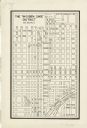
| Date: | 1940 |
|---|---|
| Description: | This map is pen and ink on paper and is map 6 in a series of 12. The map shows streets, and the Milwaukee River. |
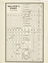
| Date: | 1940 |
|---|---|
| Description: | This map is pen and ink on paper and is map 9 in a series of 12. The map shows streets and railroad lines. |
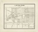
| Date: | 1940 |
|---|---|
| Description: | This map is pen and ink on paper and is map 10 in a series of 12. The map shows streets and railroad lines. |
| Date: | 1940 |
|---|---|
| Description: | This map is pen and ink on paper and is map 11 in a series of 12. The map shows streets. |
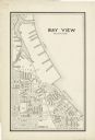
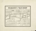
| Date: | 1940 |
|---|---|
| Description: | This map is pen and ink on paper and is map 12 in a series of 12. The map shows streets, railroad lines, the Kinnickinnic River, and Lake Michigan. |
If you didn't find the material you searched for, our Library Reference Staff can help.
Call our reference desk at 608-264-6535 or email us at: