
| Date: | 1975 |
|---|---|
| Description: | Woman in a boat showing a fish she has just caught on the Mississippi River. |
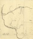
| Date: | 1972 |
|---|---|
| Description: | Ink on tracing paper. This map shows rivers, Prairie du Chien, site of Fort Crawford, Excelsior, Fort Andrew, Boscobel, Blue River, Orion, Muscoda, Castle ... |

| Date: | 1971 |
|---|---|
| Description: | This map of Nelson Dewey State Park shows the park layout, points of interest, facilities, campgrounds, roads, railroads, and the Mississippi River. Relief... |

| Date: | 1970 |
|---|---|
| Description: | This map is intended for tourists of La Crosse. The cover features images of farms and natural land and reads: "friends are but strangers... we have yet to... |

| Date: | 1972 |
|---|---|
| Description: | This map of La Crosse is a plan for the city parks and recreation areas. The cover features an explanation of the Park and Recreation plan, objectives of t... |

| Date: | 1972 |
|---|---|
| Description: | Before or after a Minnesota vs. Wisconsin Democrats softball game. Congressman David Obey holds up a concept rendering the future Richard I. Bong Memorial ... |
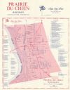
| Date: | 1976 |
|---|---|
| Description: | This map includes an index of streets, government and historic buildings, hospitals, schools, places of recreation, churches, cemeteries, and other miscell... |

| Date: | 1976 |
|---|---|
| Description: | This hand-colored map shows land divided by forest type and tree species. Also shown are counties, Lake Michigan, Lake Superior, Lake Winnebago, and the Mi... |
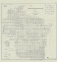
| Date: | 1975 |
|---|---|
| Description: | This map provides an index of quadrangle maps for the state. The lower left corner contains explanation land surveying completeness. Communities, counties,... |
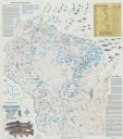
| Date: | 1975 |
|---|---|
| Description: | This map provides an index of outdated quadrangle maps for the state. Communities, counties, rivers, and lakes are labeled including Lake Michigan and Lake... |
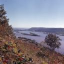
| Date: | 1972 |
|---|---|
| Description: | Elevated view looking south towards the Mississippi River from Brady's Bluff in Perrot State Park. |

| Date: | 1972 |
|---|---|
| Description: | View from the top of a grassy hill overlooking the Mississippi River. |

| Date: | 12 1976 |
|---|---|
| Description: | Towboat pushing barges through ice on the Mississippi River as winter closes shipping traffic. Elevated view shows broken ice surrounding the barges, creat... |

| Date: | 06 1978 |
|---|---|
| Description: | Elevated view of boats moored to a dock at a marina on the Mississippi River in early summer make an interesting pattern. There is a person walking on the ... |
If you didn't find the material you searched for, our Library Reference Staff can help.
Call our reference desk at 608-264-6535 or email us at: