 Filter: Categories of Wisconsin Historical Images
Filter: Subject of Mississippi River
Filter: Year of 1800-1899
Filter: Year of 1820-1829
Filter: Categories of Wisconsin Historical Images
Filter: Subject of Mississippi River
Filter: Year of 1800-1899
Filter: Year of 1820-1829

| Date: | 10 1829 |
|---|---|
| Description: | Fort Crawford as drawn by Seth Eastman. People are in a canoe in the river in the foreground. Across the river is the fort, other buildings around the fort... |

| Date: | 1829 |
|---|---|
| Description: | Drawing of Cassville depicting a horse cart on the river's edge, with men and boats. |

| Date: | 1829 |
|---|---|
| Description: | Cincinnati, Ohio, Ebr. Martin, engraver. |

| Date: | 1820 |
|---|---|
| Description: | A manuscript map of Prairie du Chien. |

| Date: | 1821 |
|---|---|
| Description: | A topographical view of the site of Fort Crawford. |

| Date: | 1829 |
|---|---|
| Description: | Fort Crawford, from a sketchbook attributed to Seth Eastman, 1808-1875. A graduate of West Point, Eastman briefly served at Fort Crawford, 1829-1839. |

| Date: | 1829 |
|---|---|
| Description: | Photoprint of Crawford County lead district map. |

| Date: | 1829 |
|---|---|
| Description: | Hand-colored lithograph of Fort Armstrong on Rock Island, based on a drawing by Henry Lewis. Foreground shows a tree floating in the water. |

| Date: | 1829 |
|---|---|
| Description: | Hand-colored lithograph of Fort Armstrong, based on a drawing by Henry Lewis. Includes boats on the Mississippi River. |

| Date: | 1828 |
|---|---|
| Description: | Plat of the Private Claims at Prairie Du Chien. |
| Date: | 1820 |
|---|---|
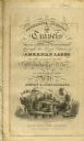
| Description: | Narrative Journal of Travels from Detroit Northwest through the Great chain of American Lakes to the sources of the Mississippi River in the year 1820. Ill... |
| Date: | 1820 |
|---|---|
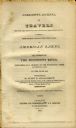
| Description: | Narrative Journal of Travels through the northwestern regions of the United States, extending from Detroit through the great chain of American lakes to the... |
| Date: | 05 24 1820 |
|---|---|
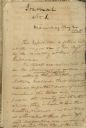
| Description: | A page, headed with "Journal No. 1," of James Doty's journal of a trip with Cass, Schoolcraft, etc. to the sources of the Mississippi River. |

| Date: | 02 1823 |
|---|---|
| Description: | A map featuring the North American expedition from Pittsburgh to the Rocky Mountains led by Edwin James. |

| Date: | 1828 |
|---|---|
| Description: | This plat map is pen-and-ink and shows landowners, the Mississippi River, the Marais de St. Friole, Fort Crawford, the town commons, and the Village of St.... |

| Date: | 1828 |
|---|---|
| Description: | This map is pen-and-ink and served as the model for the lithograph produced in 1828 by C.B. Graham. Landowners are labeled as is the Mississippi River. |

| Date: | 1829 |
|---|---|
| Description: | This map shows waterways, trails, settlements, Indian villages, and boundaries. The map includes text in the lower left with excerpts from Indian land trea... |
If you didn't find the material you searched for, our Library Reference Staff can help.
Call our reference desk at 608-264-6535 or email us at: