| Date: | 1836 |
|---|---|
| Description: | The shot tower at Tower Hill State Park. |

| Date: | 1864 |
|---|---|
| Description: | This map is pen and watercolor on paper and shows profile and geological formation of Blue Mound and location of Arnold’s Hotel and Brigham Lead Mines. |

| Date: | 1864 |
|---|---|
| Description: | This map is pen and watercolor on paper and shows a profile and the geological formation of Blue Mound. Also shown is the location of Arnold's Hotel and Br... |

| Date: | 1866 |
|---|---|
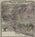
| Description: | A colorful map of Gilpin County, the central gold region of Colorado, surveyed by Charles W. Morse and George Hill. |
If you didn't find the material you searched for, our Library Reference Staff can help.
Call our reference desk at 608-264-6535 or email us at: