 Filter: Categories of Wisconsin Historical Images
Filter: Subject of Michigan, Lake
Filter: Year of 1900-1999
Filter: Reproduction Rights of For Sale
Filter: Year of 1980-1989
Filter: Categories of Wisconsin Historical Images
Filter: Subject of Michigan, Lake
Filter: Year of 1900-1999
Filter: Reproduction Rights of For Sale
Filter: Year of 1980-1989

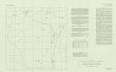
| Date: | 1987 |
|---|---|
| Description: | This 1987 map of Door County, Wisconsin, shows streets and roads, cities and villages, state parks, lakes and streams, and depths in Lake Michigan. A stree... |

| Date: | 1982 |
|---|---|
| Description: | Bird's-eye view of a large crowd of music fans gathered at Summerfest, looking northeast toward the current site of Discovery World. Sailboats are on Lake ... |

| Date: | 1989 |
|---|---|
| Description: | This pictorial map shows Lake Michigan, businesses with phone numbers, schools, parks, other points of interest, and includes a brief history of the town. ... |
| Date: | 1980 |
|---|---|
| Description: | This map shows earthquake data and includes text about tables, references, and the Modified Mercalli Intensity Scale of 1931. Table one lists earthquakes c... |

| Date: | 07 21 1985 |
|---|---|
| Description: | View of a man and a woman looking over a railing, with binoculars and a telescopic lens at hand. Caption reads: "Light keeper John Foote and researcher Lau... |
If you didn't find the material you searched for, our Library Reference Staff can help.
Call our reference desk at 608-264-6535 or email us at: