 Filter: Categories of Wisconsin Historical Images
Filter: Subject of Michigan, Lake
Filter: Type of Map or Atlas
Filter: Categories of Wisconsin Historical Images
Filter: Subject of Michigan, Lake
Filter: Type of Map or Atlas

| Date: | 1838 |
|---|---|
| Description: | This manuscript map, drawn in pencil, shows the lakes and rivers in the area between Lake of the Woods in northern Minnesota, the Mississippi River on the ... |
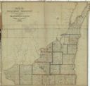
| Date: | 1837 |
|---|---|
| Description: | This map shows the townships, counties, prairies, and swamps in the Wisconsin Territory at the time. It includes the land south of the Wisconsin and Fox Ri... |

| Date: | 1839 |
|---|---|
| Description: | Wisconsin was considered part of Michigan Territory until 1836, a year before Michigan entered statehood. Drawn in 1839, this map shows the state of Michig... |

| Date: | 1844 |
|---|---|
| Description: | Wisconsin was considered part of Michigan Territory until 1836, a year before Michigan entered statehood. Drawn four years before Wisconsin entered stateho... |

| Date: | 1845 |
|---|---|
| Description: | Wisconsin was considered part of Michigan Territory until 1836, a year before Michigan entered statehood. Drawn three years before Wisconsin entered stateh... |

| Date: | 05 1846 |
|---|---|
| Description: | Hand-colored map of southeastern Wisconsin showing the counties of Dodge, Jefferson, Rock, Walworth, Racine (including modern-day Kenosha County), Waukesha... |

| Date: | 1846 |
|---|---|
| Description: | This map shows the counties and towns in existence at the time as well as lead and copper mines. |

| Date: | 1848 |
|---|---|
| Description: | Wisconsin became the thirtieth state in 1848. Drawn that same year, this map shows township lines, roads, villages, mills, railroads, prairies, swamps, can... |
| Date: | 1848 |
|---|---|
| Description: | This map shows the township and range system in southern and eastern Wisconsin as well as along the Wisconsin River in present-day Marathon, Portage, and W... |

| Date: | 1849 |
|---|---|
| Description: | Published a year after Wisconsin entered statehood, this map shows the counties and towns in existence at the time - mainly in southern/southeastern Wiscon... |

| Date: | 1849 |
|---|---|
| Description: | Published in Germany a year after Wisconsin entered statehood, this map shows prairies, swamps, lakes, mounds, limestone deposits, and lead and copper mine... |

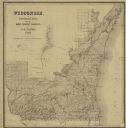
| Date: | 1850 |
|---|---|
| Description: | This detailed map outlines mid and southern WI county boundaries in bright color, and city/town lines are provided. Other marks include lead mines, copper ... |

| Date: | 1850 |
|---|---|
| Description: | Mid and southern Wisconsin counties, city/town lines, lead mines, copper mines, streams, plank roads, and the Milwaukee and Mississippi Rail Roads. |

| Date: | 1851 |
|---|---|
| Description: | Map outlines mid and southern Wisconsin county boundaries in blue, and city/town lines are provided. Other marks include mines, plank roads, and railroads. |

| Date: | 1853 |
|---|---|
| Description: | Southern two thirds of Wisconsin with county boundaries hand-colored in red. The map displays towns, railroads, plan roads and mines. The scale is ten mile... |

| Date: | 1853 |
|---|---|
| Description: | Railroad map outlines mid and southern Wisconsin county boundaries in red, and city/town lines are provided. Other marks include lead mines, copper mines, ... |

| Date: | 1854 |
|---|---|
| Description: | This map shows surveyed counties in blue, yellow, and pink, railroads, plank roads and mines. Lake Michigan, the Mississippi River, other rivers and lakes,... |

| Date: | 1854 |
|---|---|
| Description: | Brightly-colored map exhaustively marks the townships, County Towns and villages of Wisconsin. It also shows rivers, canals, railroads, and plank roads. Ea... |

| Date: | 1857 |
|---|---|
| Description: | This map shows the railroads in the entire state of Wisconsin and their connections with points in Minnesota, Iowa, Illinois, and Michigan's Upper Peninsul... |
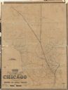
| Date: | 1855 |
|---|---|
| Description: | A map of Wisconsin and northern Illinois, showing the railroad routes in these areas, specifically the Fox River Valley, Wisconsin Central and the Ontonago... |
If you didn't find the material you searched for, our Library Reference Staff can help.
Call our reference desk at 608-264-6535 or email us at: