 Filter: Categories of Wisconsin Historical Images
Filter: Subject of Medicine
Filter: Subject of blueprints
Filter: Categories of Wisconsin Historical Images
Filter: Subject of Medicine
Filter: Subject of blueprints

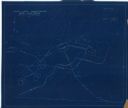
| Date: | 07 28 1934 |
|---|---|
| Description: | This map shows buildings and dimensions of Fort Crawford and hospital overlaid on a plat of existing lots, streets, and closed streets. |
| Date: | 1935 |
|---|---|
| Description: | This manuscript blueprint map shows buildings, water works, a stone wall, and paths. |
If you didn't find the material you searched for, our Library Reference Staff can help.
Call our reference desk at 608-264-6535 or email us at: