 Filter: Categories of Wisconsin Historical Images
Filter: Subject of Marshes
Filter: Year of 1900-1999
Filter: Type of Map or Atlas
Filter: Categories of Wisconsin Historical Images
Filter: Subject of Marshes
Filter: Year of 1900-1999
Filter: Type of Map or Atlas

| Date: | 1972 |
|---|---|
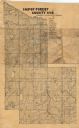
| Description: | This map on 5 sheets features a title page sheet with business directory and shows section numbers, roads, railroads, saw mills, churches, blacksmith shops... |

| Date: | 1916 |
|---|---|
| Description: | This Wisconsin Conservation Commission map from 1916 shows Peninsula State Park in the Town of Gibraltar, Door County, Wisconsin. Depicted are open and pla... |

| Date: | 1916 |
|---|---|
| Description: | This version of a 1916 Wisconsin Conservation Commission map shows Peninsula State Park in the Town of Gibraltar, Door County, Wisconsin. Depicted are open... |

| Date: | 1914 |
|---|---|
| Description: | This early 20th century map shows the township and range system, sections, railroads, roads, lakes, wetlands, and streams in the western Sawyer County town... |

| Date: | 1974 |
|---|---|
| Description: | This 1968 map identifies resorts in the Lac du Flambeau Indian Reservation region of Wisconsin, covering parts of Iron, Vilas, Oneida, and Price counties. ... |

| Date: | 1968 |
|---|---|
| Description: | This map is ink and color on printed grid. Shows geology, portage trails, timber type, some landownership, hydrology, and marshes in part of Florence Count... |
| Date: | 1908 |
|---|---|
| Description: | Map shows swamps, windfalls, roads and railroads. Status of some land marked (O, S, X) but lacks explanation. |

| Date: | 1975 |
|---|---|
| Description: | This map shows settlers, Indian trails, roads, marshes, and forests as they appeared in 1800-1840. "A bicentennial map of Racine County for the benefit of ... |

| Date: | 1910 |
|---|---|
| Description: | Shows existing and proposed parks, railroads, and marshes in a color coded key. "Contour interval 20 feet." Lake Wingra, Lake Mendota, and Lake Monona are ... |

| Date: | 1908 |
|---|---|
| Description: | Title at top: "G.F. Sanborn Company Timber and Farming Lands." Map shows acreages, roads, railroads, and swamps in parts of Vilas and Oneida counties. |

| Date: | 1975 |
|---|---|
| Description: | This standard U.S.G.S. topographic map was annotated by civil engineer and railroad historian James P. Kaysen to show the location of existing and defunct ... |

| Date: | 1932 |
|---|---|
| Description: | This map shows local streets, section lines, Nakoma Country Club, part of Lake Forest, and part of Lake Wingra. The map includes a legend showing areas of ... |

| Date: | 1982 |
|---|---|
| Description: | Color map. "Topography by photogrammetric methods from aerial photographs taken 1963. Revised from aerial photographs taken 1978. Field checked 1979. Map e... |

| Date: | 1930 |
|---|---|
| Description: | Original map made with watercolor and inkwash. Includes a legend of buildings, roads, natural features and other details of the lodge. Inset at bottom has ... |

| Date: | 1900 |
|---|---|
| Description: | This photostat of a manuscript map originally drawn in 1829 shows landownership, buildings, including Fort Howard and U.S. sawmill, swamps, public barns an... |

| Date: | 1911 |
|---|---|
| Description: | This map shows lakes, rivers, swamps, state swamp land, trails and railroads. Includes a township diagram. |

| Date: | 1912 |
|---|---|
| Description: | This map shows a school reserve, swamp land, railroads, and selected buildings. |

| Date: | 1951 |
|---|---|
| Description: | This map shows land use, dwellings, resorts, camps, marshes, springs, dams, lake bottom composition, and access. The map includes a fish species table, geo... |

| Date: | 1900 |
|---|---|
| Description: | This map shows portion of the military road from Fond du Lac to the Wisconsin River near Fort Winnebago, with mile markers and adjacent land use. A few pro... |
If you didn't find the material you searched for, our Library Reference Staff can help.
Call our reference desk at 608-264-6535 or email us at:
