Filter: Categories of Wisconsin Historical Images
Filter: Subject of Maps
Filter: Subject of cities and towns
Filter: Type of Photograph
Filter: Categories of Wisconsin Historical Images
Filter: Subject of Maps
Filter: Subject of cities and towns
Filter: Type of Photograph

| Date: | 1870 |
|---|---|
| Description: | Bird's-eye view of the city of Manitowoc with a population of 5,168 inhabitants as it appears in 1870, the year the village was granted a city charter by t... |
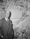
| Date: | 01 1947 |
|---|---|
| Description: | Joseph W. Jackson (Col. Bud), executive director of the Madison and Wisconsin Foundation, standing next to a map of the isthmus. |

| Date: | 1920 |
|---|---|
| Description: | Calumet Harbor on Lake Winnebago. On the left is a map, and on the right are two images, one captioned: "Calumet Harbor". |

| Date: | 1917 |
|---|---|
| Description: | The Lake Forest community plan, a model community that was planned for the site where the University of Wisconsin Arboretum now stands. |

| Date: | 11 10 1944 |
|---|---|
| Description: | Mayor F. Halsey Kraege standing in front of a 1930 City of Madison map. |

| Date: | 03 17 1947 |
|---|---|
| Description: | Wisconsin Felton Sporting Goods window display of state map and pairings chart for 1947 State Basketball Tournament. "Welcome State Tournament Fans." |
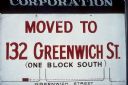
| Date: | 1969 |
|---|---|
| Description: | A sign reads that a business has "Moved to 132 Greenwich St. (one block south)." Along with the written description, there is a small map to show where the... |

| Date: | 1930 |
|---|---|
| Description: | Exterior view of the Triangle filling station on Highway 12, which sold gasoline, ice, and other items. A man stands in front by the gas pump, and a map of... |
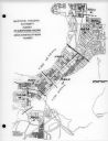
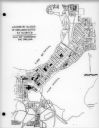
| Date: | 03 16 1950 |
|---|---|
| Description: | Map of areas surveyed by block number as part of the Madison Housing Authority Survey of Substandard Housing. |
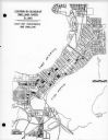
| Date: | 03 16 1950 |
|---|---|
| Description: | Map of locations by block of dwellings rated as blighted as part of the Madison Housing Authority Survey of Substandard Housing. |
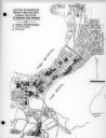
| Date: | 03 16 1950 |
|---|---|
| Description: | Map of locations of blocks of dwellings rated as slums, as part of the Madison Housing Authority Survey of Substandard Housing. |
| Date: | 03 16 1950 |
|---|---|
| Description: | Map of locations by blocks or areas of dwelling units in which violations of ordinance were apparent as part of the Madison Housing Authority Survey of Sub... |

| Date: | 03 16 1950 |
|---|---|
| Description: | A chart showing distribution of 1,148 substandard dwelling units found in the survey area, by basic type of fault, as part of the Madison Housing Authority... |

| Date: | 1913 |
|---|---|
| Description: | Exhibit featuring maps, drawings, photographs, and compositions. |
| Date: | |
|---|---|
| Description: | Display of student work, including maps, drawings, and essays. |
| Date: | |
|---|---|
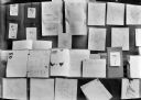
| Description: | Display of student work including drawings, maps, and essays. |

| Date: | 11 10 1933 |
|---|---|
| Description: | A map of IH branch houses and factories in Canada. The legend includes markings for branch houses, transfer warehouses, factories, and motor truck branches... |

| Date: | 06 17 1933 |
|---|---|
| Description: | A map of International Harvester branch houses in both Canada and the United States. |

| Date: | 1887 |
|---|---|
| Description: | A bird's-eye map of Menekaune, Menominee and Marinette. |
If you didn't find the material you searched for, our Library Reference Staff can help.
Call our reference desk at 608-264-6535 or email us at: