 Filter: Categories of Wisconsin Historical Images
Filter: Subject of Lumber trade
Filter: Subject of lumber trade
Filter: Creator Name of Sanborn Map Company
Filter: Categories of Wisconsin Historical Images
Filter: Subject of Lumber trade
Filter: Subject of lumber trade
Filter: Creator Name of Sanborn Map Company

| Date: | 12 1912 |
|---|---|
| Description: | Sanborn Map of Sun Prairie. The map highlights the public and parochial schools, the exhange, and church buildings, etc. |

| Date: | 1892 |
|---|---|
| Description: | A Sanborn map of St. Louis, which is six miles southwest of South Superior. |
| Date: | 05 1894 |
|---|---|
| Description: | Sheet 5 of an Sanborn map of Onalaska featuring the Island Lumber Company. |

| Date: | 1901 |
|---|---|
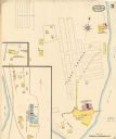
| Description: | A Sanborn map of Tomahawk featuring the Bay Mill Company's lumber yard. |

| Date: | 10 1894 |
|---|---|
| Description: | A Sanborn Fire Insurance Map of Waunakee. |

| Date: | 09 1918 |
|---|---|
| Description: | An insurance map of Washburn, with an index and a key. Includes a small inset map of the State of Wisconsin that shows "Location of this town as above unde... |

| Date: | 1892 |
|---|---|
| Description: | A Sanborn fire insurance map of Sauk City which was drawn up in 1892. |

| Date: | 1900 |
|---|---|
| Description: | A Sanborn fire insurance map of Sauk City created in 1900. |

| Date: | 1915 |
|---|---|
| Description: | A Sanborn fire insurance map of Sauk City created in 1915. |

| Date: | 1900 |
|---|---|
| Description: | A Sanborn fire insurance map of Sauk City created in 1900. |
If you didn't find the material you searched for, our Library Reference Staff can help.
Call our reference desk at 608-264-6535 or email us at:


