 Filter: Categories of Wisconsin Historical Images
Filter: Subject of Lumber trade
Filter: Type of Map or Atlas
Filter: Year of 1900-1999
Filter: Categories of Wisconsin Historical Images
Filter: Subject of Lumber trade
Filter: Type of Map or Atlas
Filter: Year of 1900-1999

| Date: | 1910 |
|---|---|
| Description: | Bird's-eye view looking east, with Washburn Harbor at center and Chequamegon Bay in Lake Superior covering most of the upper image. Streets with buildings... |

| Date: | 1917 |
|---|---|
| Description: | This map, which highlights the land for sale by the Rust-Owen Lumber Company in the towns of Drummond, Cable and Grandview, Bayfield County, Wisconsin, sho... |

| Date: | 1900 |
|---|---|
| Description: | Shows limits of drainage basin, dams, rapids, roads, and railroads in parts of Iron and Vilas Counties, Wisconsin. From the E.P. Sherry papers relating to ... |

| Date: | 1925 |
|---|---|
| Description: | Shows buildings, piers, winter and summer levels, and resort lands. Depths shown by isolines. Relief shown by contours. From the E.P. Sherry papers relatin... |
| Date: | 1920 |
|---|---|
| Description: | Shows geology, test pits, shafts, houses, and the Mellen Lumber Co. Ry. in Marengo township, Ashland County, Wisconsin. "This is a preliminary map issued i... |

| Date: | 1908 |
|---|---|
| Description: | Title at top: "G.F. Sanborn Company Timber and Farming Lands." Map shows acreages, roads, railroads, and swamps in parts of Vilas and Oneida counties. |
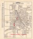
| Date: | 1924 |
|---|---|
| Description: | This map of Janesville was distrusted by the Fifield Lumber Company and features labeled streets, the Rock River, and Fifield Lumber Company buildings in r... |

| Date: | 06 1923 |
|---|---|
| Description: | Sanborn map of Ashland, which includes Chequamegon Bay. |

| Date: | 1982 |
|---|---|
| Description: | This standard U.S.G.S. topographic map was annotated by civil engineer and railroad historian James P. Kaysen to show the location of existing and defunct ... |

| Date: | 1912 |
|---|---|
| Description: | Marinette plat map, Township 37 N., Range 19 E. |

| Date: | 1912 |
|---|---|
| Description: | Marinette County, Township 37 N., Range 20 E. |

| Date: | 1912 |
|---|---|
| Description: | Marinette County, Fract. Township 36 N., Ranges 21 and 22 E. |

| Date: | 12 1912 |
|---|---|
| Description: | Sanborn Map of Sun Prairie. The map highlights the public and parochial schools, the exhange, and church buildings, etc. |

| Date: | 1972 |
|---|---|
| Description: | A topographic map of the Blackwell quadrangle. |

| Date: | 1901 |
|---|---|
| Description: | A Sanborn map of Tomahawk featuring the Bay Mill Company's lumber yard. |
If you didn't find the material you searched for, our Library Reference Staff can help.
Call our reference desk at 608-264-6535 or email us at:


