 Filter: Categories of Wisconsin Historical Images
Filter: Subject of Lumber
Filter: Type of Map or Atlas
Filter: Year of 1900-1999
Filter: Categories of Wisconsin Historical Images
Filter: Subject of Lumber
Filter: Type of Map or Atlas
Filter: Year of 1900-1999

| Date: | 1972 |
|---|---|
| Description: | This map on 5 sheets features a title page sheet with business directory and shows section numbers, roads, railroads, saw mills, churches, blacksmith shops... |

| Date: | 07 07 1915 |
|---|---|
| Description: | Ink on tracing cloth. Includes signed certifications from the surveyor, notary public, and Wisconsin Realty Company. From the E.P. Sherry papers relating t... |

| Date: | 1917 |
|---|---|
| Description: | Shows landownership, buildings, and swamps around Rest Lake in Vilas County, Wisconsin. Relief shown by contours. "May 1917." From the E.P. Sherry papers r... |

| Date: | 1926 |
|---|---|
| Description: | Relief shown by hachures. Shows local streets, roads, railroads, businesses, Half Moon Lake, Chippewa River, and log reservoir. |
| Date: | 1927 |
|---|---|
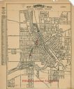
| Description: | This map shows a plat of city, a numbering system, local streets, railroads, and part of the Rock River. The map is indexed by street name and reads: "Copy... |

| Date: | 1974 |
|---|---|
| Description: | Map of Wisconsin with drawings illustrating historic places and events throughout the state. The Great Seal of the State of Wisconsin appears at the top ri... |

| Date: | 1900 |
|---|---|
| Description: | This map shows logging roads, railroads with spur lines, trails, rapids, lumber camps, Indian villages, summer resort, lakes, rivers, and ponds. |

| Date: | 1902 |
|---|---|
| Description: | This map shows townships, land parcels, schools, rivers, lakes, creameries, churches, cemeteries, roads, post offices, town halls, saw mills, roads and sto... |
If you didn't find the material you searched for, our Library Reference Staff can help.
Call our reference desk at 608-264-6535 or email us at: