Filter: Categories of Wisconsin Historical Images
Filter: Subject of Landscape
Filter: Subject of outdoor photography
Filter: Categories of Wisconsin Historical Images
Filter: Subject of Landscape
Filter: Subject of outdoor photography

| Date: | |
|---|---|
| Description: | Elevated view from bluff of a house in Cassville surrounded by bluffs, trees and farmland. Railroad tracks run between the crops and the trees, and the Mis... |
| Date: | 1900 |
|---|---|
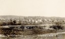
| Description: | Bird's-eye view of Cazenovia, with a bridge in the foreground, the town, and in the distance a low hill in the background. Caption reads: "Bird's Eye View... |
| Date: | |
|---|---|
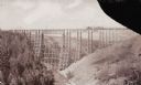
| Description: | Two Medicine Bridge, part of the Gulf and Northern Railroad. |
| Date: | |
|---|---|
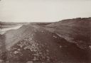
| Description: | The Fort Smith Bluffs at the Big Horn Ditch on the Crow Reservation in northeast Wyoming. |
| Date: | 1910 |
|---|---|
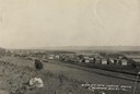
| Description: | Slightly elevated view of Cochrane from a field. A road or highway stands between the field and Cochrane. Caption reads: "Birds [sic] Eye View Looki... |
| Date: | 1901 |
|---|---|
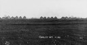
| Description: | Thirteen unfinished houses in a row, on the horizon of a field. Captin reads: "Corliss Wis In 1901". |

| Date: | 05 10 1928 |
|---|---|
| Description: | The Lutheran Church and buildings, seen from Lutheran Church Hill. |
| Date: | 1928 |
|---|---|
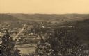
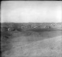
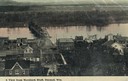
| Description: | View from hill of uptown Cross Plains with the Catholic Church (St. Francis Xavier) and farmhouses. |

| Date: | 1910 |
|---|---|
| Description: | Elevated view of the Pecatonica River, which is curving from left to right, making two hairpin turns among fields and trees. Hills are in the distance. |
| Date: | 1905 |
|---|---|
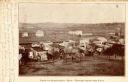
| Description: | Elevated view of the town. Caption reads: "Part of Deerfield, Wis. -- viewed from the East". Handwritten note: "Dear Ella, Here comes the postal I am owing... |

| Date: | 1902 |
|---|---|
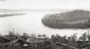
| Description: | River with distant hills behind a town. An island is in the foreground. |
| Date: | 1948 |
|---|---|
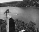
| Description: | View from the east bluff of lake with a motorboat. A geologic pinnacle juts out from the lower left of the image. |
| Date: | |
|---|---|
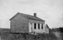
| Description: | View of the one-room schoolhouse, located 2 1/2 miles south of Dickeyville. |
| Date: | 1900 |
|---|---|
| Description: | Elevated view of Durand. A street in the foreground leads to a bridge that crosses the river. Caption reads: "A View from Morsbach Bluff, Durand, Wis." |
| Date: | |
|---|---|
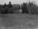
| Description: | Rock Studio across a field, surrounded by trees. |
| Date: | |
|---|---|
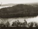
| Description: | Elevated view of the "mount" and the wide river before it and behind it. Houses and smokestacks can be seen in the far distance. |
| Date: | |
|---|---|
| Description: | Elevated view of a bow in the river, and a homestead on the shore, with a two-story house and a barn. Two wagons are close to the barn in the lower left co... |
| Date: | |
|---|---|
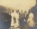
| Description: | A boat trip group, possibly William Arthur Jones and others. |
| Date: | 04 01 1907 |
|---|---|
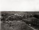
| Description: | Elevated view of the west end of Fairchild. |
If you didn't find the material you searched for, our Library Reference Staff can help.
Call our reference desk at 608-264-6535 or email us at: