Filter: Categories of Wisconsin Historical Images
Filter: Subject of Landforms
Filter: Subject of botany
Filter: Creator Name of Unknown
Filter: Categories of Wisconsin Historical Images
Filter: Subject of Landforms
Filter: Subject of botany
Filter: Creator Name of Unknown
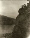
| Date: | 1945 |
|---|---|
| Description: | Two fishermen on rocks alongside the Pike River. |
| Date: | 1913 |
|---|---|
| Description: | Elevated view of Taliesin. Taliesin is located in the vicinity of Spring Green. |
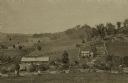
| Date: | 1875 |
|---|---|
| Description: | View from a distance of a farm in a valley owned by Alex(ander?) Smith. There is a wooden fence in the foreground surrounding the farm. |
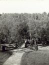
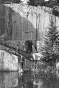
| Date: | |
|---|---|
| Description: | Two people on a rustic bridge over Bad River at Copper Falls State Park. |

| Date: | 1872 |
|---|---|
| Description: | The sidewheel packet, Red Wing, in the Mississippi River near Queen's Bluff below Trempealeau, Wisconsin. |

| Date: | 1874 |
|---|---|
| Description: | Bird's-eye map of Chippewa Falls. |

| Date: | 1860 |
|---|---|
| Description: | Bird's-eye drawing of New Glarus. |
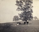
| Date: | 1900 |
|---|---|
| Description: | Fenced-in, the cattle find a grassy pasture of Observatory Hill below Washburn Observatory on the University of Wisconsin-Madison campus. |
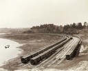
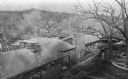
| Date: | 05 05 1897 |
|---|---|
| Description: | Elevated view of Wisconsin Central freight cars in a rural storage yard near Manitowoc. |

| Date: | 1875 |
|---|---|
| Description: | Aerial view of Alma along Mississippi River, with bluffs along the horizon. |
| Date: | |
|---|---|
| Description: | Elevated view from hill of the road between the railroad and the Mescalero Agency, which is surrounded by a sixty by twenty mile section of white sands, co... |

| Date: | 1902 |
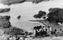
|---|---|
| Description: | River with distant hills behind a town. An island is in the foreground. |
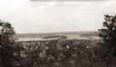
| Date: | |
|---|---|
| Description: | Elevated view of the residential section of Eau Claire from Mount Tom. |

| Date: | 1924 |
|---|---|
| Description: | Aerial view of Madison's Willow Beach towards the University of Wisconsin-Madison campus, downtown Madison, and Lake Monona. |
| Date: | |
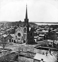
|---|---|
| Description: | Elevated view of the First Congregational Church and chapel at the corner of North Fairchild Street and West Washington Avenue. The Gates of Heaven Synagog... |
| Date: | 1955 |
|---|---|
| Description: | Aerial view of Treeland Pines resort on Lake Chippewa. Caption reads: "Air View of Bob Cammack's Treeland Pines Resort; Lake Chippewa, Hayward, Wis." |
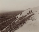
| Date: | 1929 |
|---|---|
| Description: | View of the rock formation known as the "Old Man of the Dalles" in the Interstate State Park near Saint Croix Falls, Wisconsin. The St. Croix River is in t... |
| Date: | 1901 |
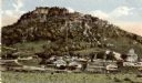
|---|---|
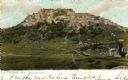
| Description: | Grand Dad Bluff in La Crosse with the Crusher building which was built in 1901 and burned in 1902. Caption reads: "Grand Dad Bluff, La Crosse, Wis." |

| Date: | 1909 |
|---|---|
| Description: | View from the University of Wisconsin service building smokestack of south Madison, including Mills Street, Mound Street, and the Greenbush. Lake Monona is... |
If you didn't find the material you searched for, our Library Reference Staff can help.
Call our reference desk at 608-264-6535 or email us at: