 Filter: Categories of Wisconsin Historical Images
Filter: Subject of Land use, Urban
Filter: County of Milwaukee
Filter: Type of Map or Atlas
Filter: Categories of Wisconsin Historical Images
Filter: Subject of Land use, Urban
Filter: County of Milwaukee
Filter: Type of Map or Atlas

| Date: | 1947 |
|---|---|
| Description: | This map of Wauwatosa shows 10 zoning class types of land including residential, manufacturing, and business. The map also shows government buildings, some... |

| Date: | 1939 |
|---|---|
| Description: | This is a zoning map of Wauwatosa with a key of districts including agricultural, resident, business, commercial, and industrial. The map features labeled ... |

| Date: | 1940 |
|---|---|
| Description: | This map of Granville visually shows different types of zones: agricultural areas, "A" residence, "B" residence, local businesses, commercial and light man... |

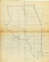
| Date: | 1850 |
|---|---|
| Description: | This map of the Town of Lake is ink and pencil on paper and shows lots and acreages, reserved land, and public squares. The bottom of the map includes a ke... |

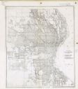
| Date: | 1902 |
|---|---|
| Description: | This map is a chart of Milwaukee Harbor that displays local streets, bridges, roads, railroads, public buildings, businesses, factories, dry docks, parks, ... |

| Date: | 1964 |
|---|---|
| Description: | This map shows various zoning sections and includes labeled streets, parks, and cemeteries. The upper left corner contains a legend of land use. |
| Date: | 02 25 1965 |
|---|---|
| Description: | This blue line print map shows annexed land with ordinance numbers and dates. |

| Date: | 1965 |
|---|---|
| Description: | This map shows 32 zoning districts, house numbering system, parks, cemeteries, and Milwaukee County institutional buildings. |
| Date: | 12 11 1933 |
|---|---|
| Description: | This map shows residence, business, commercial, and industrial districts as well as streets, points of interest, and Lake Michigan. |
| Date: | 1956 |
|---|---|
| Description: | This blueline print map shows streets, pedestrian pathways, plans to widen existing streets, and streets and alleys vacated and to be vacated. The upper le... |

| Date: | 2005 |
|---|---|
| Description: | This map shows dams and falls, areas of portage, canoe and kayak access, boat launches, parking, restrooms, picnic areas, dining, rapid water, parks, and b... |

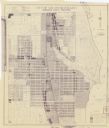
| Date: | 1880 |
|---|---|
| Description: | A map of Milwaukee which includes a city street guide. |
If you didn't find the material you searched for, our Library Reference Staff can help.
Call our reference desk at 608-264-6535 or email us at: